 Cary 1789

|

|
|
|
item:- private collection (291) image:- © see bottom of page |
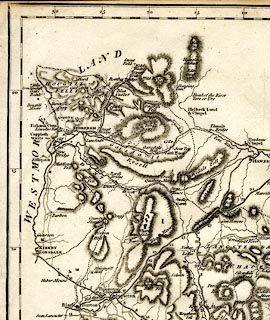
click to enlarge |
|
|
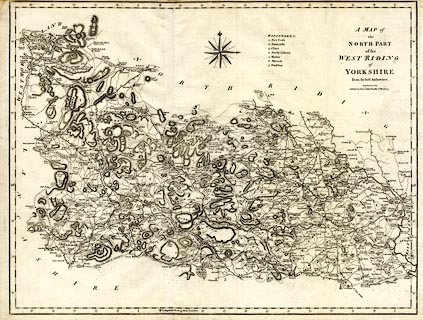
Map, uncoloured engraving, Map of the North Part of the
West Riding of Yorkshire, scale about miles to 1 inch, by
John Cary, London, 1789; edition published by John
Stockdale, Piccadilly, London, 1805.
First published in an edition of Camden's Britannia; this edition included in the New British Atlas. |
||

|
Cary 1789 | |
| map feature:- | compass rose & up is N & scale line & lat and long scales (rectangular projection) & rivers & relief & hill hachuring & woods & parks & county & hundreds (wapontakes) & table of hundreds (wapontakes) & settlements & roads | |
| inscription:- |
printed lower right
A MAP of / the / NORTH PART / of the / WEST RIDING / of / YORKSHIRE / From the best Authorities. / Engraved by J. Cary. / Published by John Stockdale Piccadilly 26th. March 1805. |
|
| scale:- | (from 30m lat = 280 mm) | |
| wxh, sheet:- | 56x42cm | |
| wxh, map:- | 533x407mm | |
|
||