 Senex 1719-57

|

|
|
|
item:- private collection (272_2) image:- © see bottom of page |
click to enlarge |
|
|
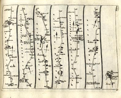
Strip map, road map, part of The Road from London to
Carlisle in Cumberland, including from Lancaster,
Lancashire; through Burton, Kendal, Shap, Westmorland; then
Penrith to Carlisle, Cumberland, by John Senex, The Globe,
Salisbury Court, Fleet Street, London, 1719.
Plate 38 in An Actual Survey of all the Principal Roads of England and Wales. |
||

|
Senex 1719-57 | |
| map feature:- | title cartouche & plain cartouche & north point & up is destination & rivers & relief & hillocks & county & settlements & roads & road distances & distances from London | |
| inscription:- |
printed bottom right
38 |
|
| wxh, sheet:- | 24x19cm | |
| wxh, plate:- | 212x159mm | |
| wxh, map:- | 211x152mm (approx) | |