 Cary 1790

|

|
|
|
item:- private collection (251) image:- © see bottom of page |
click to enlarge |
|
|
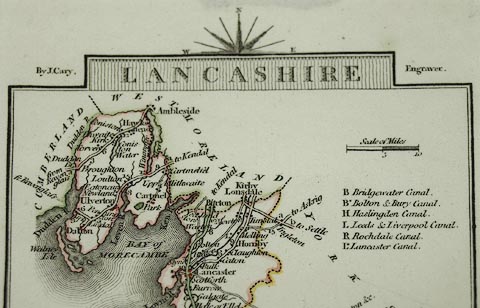
Road map, Lancashire, scale about 32 miles to 1 inch, by
John Cary, 181 Strand, London, 1790, edn 1819.
Published in Cary's Traveller's Companion, an atlas of turnpike routes, from 1790 onwards. |
||

|
Cary 1790 | |
| map feature:- | compass rose cartouche & compass rose & up is N & scale line & sea plain & coast form lines & rivers & lakes & parks & county & settlements & roads & road distances & distances from London & canals & electoral data | |
| inscription:- |
printed title cartouche, at top
LANCASHIRE |
|
| inscription:- |
printed either side of the title cartouche
By J. Cary. / Engraver. |
|
| inscription:- |
printed bottom
London Published Jan. 1. 1819 by J. Cary, Engraver No.181 Strand. |
|

|
||