 OS County Series

|

|
|
|
item:- private collection (55) image:- © see bottom of page |
click to enlarge |
|
|
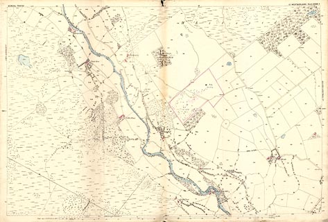
County Series map, Westmorland sheet 33.04, part of
Longsleddale, then in Kendal Parish, Westmorland, scale 25
inches to 1 mile, published by the Ordnance Survey,
Southampton, Hampshire, about 1890s?
|
||

|
OS County Series | |
| inscription:- |
printed top left and right
KENDAL PARISH / Co. WESTMORLAND Sheet XXXIII.4 |
|
| scale line:- | 1 mile = 647.2 mm | |
| scale:- | 1 to 2500 ? (nominal; 1 to 2487 from scale line) | |
| wxh, map:- | 965x645mm | |