 Dispatch 1863

|

|
|
|
item:- JandMN (442) image:- © see bottom of page |
click to enlarge |
|
|
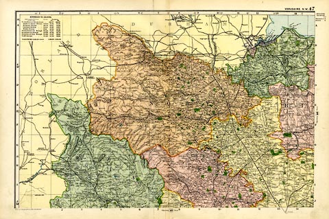
Map, colour lithograph, Yorkshire NW, first drawn by
Edward Weller for the Weekly Dispatch newspaper, 1856-62,
published by G W Bacon, Bacon's Geographical Establishment,
London, 1895-97.
Plate 47 in the Commercial and Library Atlas of the British Isles. One of four sheets for the county, other sheets may have title, scale line etc; railways are a prominent feature. Version of this map were published from 1850s to 1930s. |
||

|
Dispatch 1863 | |
| map feature:- | up is N & lat and long scales (trapezoidal projection) & index grid (1..14, A..J on this sheet) & table of data (population) & sea tinted & coast tinted & rivers & relief & hill hachuring & parks & county & electoral data & settlements & roads & canals & railways | |
| inscription:- |
printed bottom left
Bacon's Geographical Establishment |
|
| wxh, sheet:- | 52x34.5cm | |
| wxh, map:- | 466x305mm | |