button to main menu Furness Railway 1900s

item:-
JandMN (215)
image:-
©  see bottom of page
image, button to large image
click to enlarge


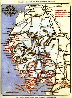
Railway map, colour printed reproduction, Map of the Furness Railway and Connections, by the Furness Railway, Cumbria, early 20th century.
Included in a facsimile reproduction of The Illustrated Guide to the Holiday Resorts on the Furness Railway, published anonymously, 2000s.
   Furness Railway 1900s
map feature:- table of symbols & north point & up is N & scale line & sea tinted & coast line & rivers & lakes & relief & hill hachuring & settlements & roads & railways
inscription:- printed upper left
MAP OF THE / Furness Railway / AND CONNECTIONS
wxh, sheet:- 21x28cm