 Symons 1860 maps

|

|
|
|
item:- Armitt Library : A4043.1 image:- © see bottom of page |
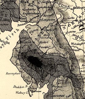
click to enlarge |
|
|
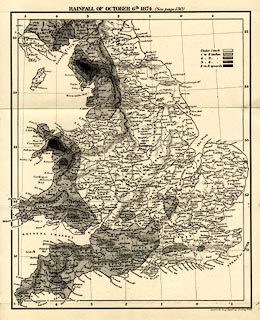
Rainfall map, Rainfall of October 6th 1874, using
isohyets, England and Wales, by G J Symons and Stanford's
Geographical Establishment, published by Edward Stanford and
Co, 6 Charing Cross, and Simpkin, Marshall and Co,
Stationers' Hall Court, London, 1875.
Frontispiece to British Rainfall 1874. |
||

|
Symons 1860 maps | |
| map feature:- | table of symbols (isohyet explanation) & up is N & lat and long scales & lat and long grid (1x1 degree graticule) & sea plain & coast line & rivers & relief & hill hacuring & county & settlements & rainfall (isohyets) | |
| inscription:- |
printed top
RAINFALL OF OCTOBER 6TH. 1874. |
|
| inscription:- |
printed bottom right
Stanford's Geogl. Estabt. 55 Charing Cross |
|
| wxh, sheet:- | 21x27cm | |
| wxh, map:- | 185x228mm | |
|
||