 Greenwood 1824

|

|
|

|
detail menu
|
|
|
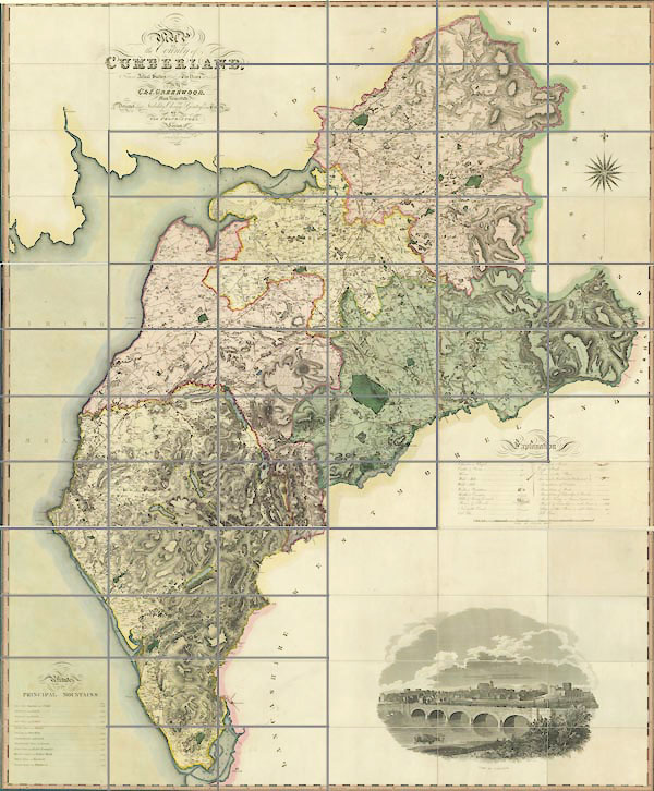
Map, engraving, Map of the County of Cumberland, scale
about 1 inch to 1 mile, etc, by Christopher and John
Greenwood, published by George Pringle jnr, 70 Queen Street,
Cheapside, London, 1823.
|
||
|
|
Greenwood 1824 | |
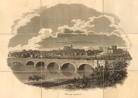
| map feature:- | sectioned for folding (3 pieces, each 6x4) & mounted & folded & slip case (like a leather full bound book) & vignettes (VIEW OF CARLISLE) & table of symbols & compass rose & up is N & scale line & lat and long scales (trapezoid projection) & sea plain & coast form lines & rivers & lakes & relief & hill hachuring & woods & trees & forests & parks & county & wards (hundreds) & settlements & roads & turnpike roads & road distances & canals | |
| inscription:- |
printed upper left
MAP / OF / the County of / CUMBERLAND / ... |
|
| inscription:- |
printed above scale line
SCALE OF STATUTE MILES. |
|
| scale line:- | 7+1 miles = | |
| wxh, sheet:- | 62x153cm | |
|
image:- © National Library of Scotland |
|
|