 Hill 1754

|

|
|
|
item:- Carlisle Library : Map 211 image:- © Carlisle Library |
click to enlarge |
|
|
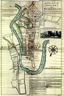
Town plan, A Plan of Appleby in Westmorland, scale about
32 ins to 1 mile, engraved by Nathaniel Hill, 1754.
There is a vignette 'The North East VIEW of the CASTLE.' |
||

|
Hill 1754 | |
| map feature:- | table of symbols & vignettes & compass rose & up is SE (SSE) & scale line & rivers & relief & hill hachuring & settlements & roads | |
| inscription:- |
printed plain cartouche, upper right
A PLAN OF / APPLEBY / IN / WESTMORLAND / From an Actual Survey taken 1754. |
|
| inscription:- |
printed bottom right
Nath. Hill Sc. |
|
| inscription:- |
printed with scale line
CHAINS |
|
| scale line:- | 12 chains = 121.1 mm | |
| wxh, sheet:- | 49.5x72cm | |
| wxh, map:- | 473x697mm | |
| scale:- | 1 to 2000 ? (1 to 1993 from scale line) | |
|
images:- © Carlisle Library |
|
|
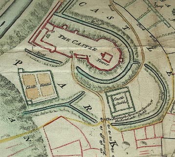
| Illustration of part of map only. | ||
|
||
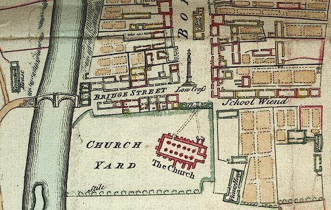
| Illustration of part of map only. | ||