 Jefferys 1770

|

|
|

|
menu with map squares and placename index | |
|
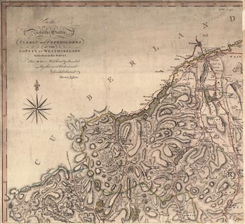
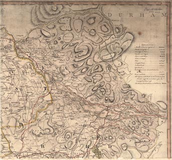
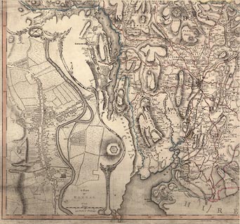
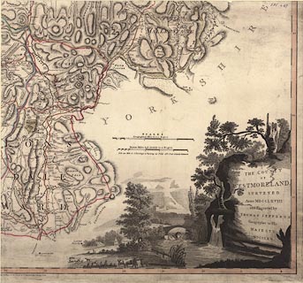
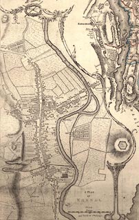
Map, The County of Westmoreland, scale 1 inch to 1 mile,
surveyed 1768, and engraved and published by Thomas
Jefferys, London, 1770.
There is an inset map of Kendal. The decoration around the title is a mountain scene, on a bridge are three surveyors, one with a waywiser. Images of the map courtesy of the Trustees of the National Library of Scotland. |
||
|
|
Jefferys 1770 | |
| inscription:- |
printed lower right
THE COUNTY / OF / WESTMORELAND, / SURVEYED / Anno MDCCLXVIII / and Engraved by / THOMAS JEFFERYS / Geographer to His / MAJESTY / MDCCLXX. |
|
| inscription:- |
printed upper left
To the / Nobility Gentry / CLERGY and FREEHOLDERS / OF THE / COUNTY OF WESTMORELAND / Subscribers to this SURVEY. / This MAP is Most humbly Inscribed / By their most Obedient and / Devoted Servant / Thomas Jefferys. dedication |
|
| inscription:- |
printed with scale line
SCALES / Geographical Miles 60 to a Degree / Statute Miles 69 1/2 nearly to a Degree / N.B. one Mile is 8 Furlongs a Furlong 40 Poles 16 1/2 Feet Statute Measure |
|
| scale line (statute):- | 4+1 miles = 125.3 mm | |
| wxh, sheet (combined):- | 111x105cm | |
| wxh, map (combined):- | 1069x989mm | |
| scale:- | 1 to 64000 ? (1 to 64220 from scale line) | |
| wxh, sheet A:- | 56x53cm | |
| wxh, sheet B:- | 55x53cm | |
| wxh, sheet C:- | 55x52cm | |
| wxh, sheet D:- | 55x52cm | |
| wxh, map A:- | 536x494mm | |
| wxh, map B:- | 533x494mm | |
| wxh, map C:- | 534x495mm | |
| wxh, map D:- | 536x494mm | |
|
Inset map of Kendal image:- © National Library of Scotland |
|
|
|
|
notes about milestones | |