 Ptolemy 1540

|

|
|
|
item:- private collection (131) image:- © see bottom of page |
click to enlarge |
|
|
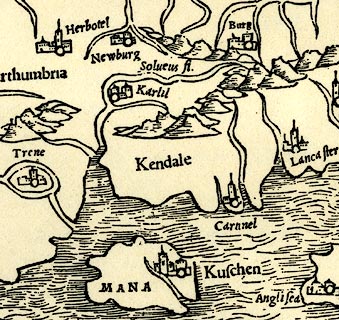
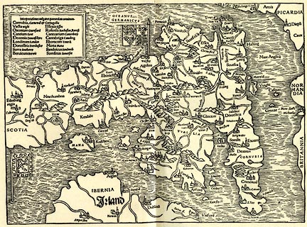
Map, copy, uncoloured lithograph? Anglia II Nova Tabula,
New Map of England, scale about 50 miles to 1 inch, data in
the Geographia by Claudius Ptolemy, engraved by Sebastian
Munster, Basle, Switzerland, 1540.
The map shows all of England and Wales, with the southern part of Scotland, eastern part of Ireland and some of the coast of France. |
||

|
Ptolemy 1540 | |
| map feature:- | coat of arms (England and Scotland, on flags) & up is E & sea wave effect & coast line & rivers & relief & hillocks & county & settlements & table of data (identifications of some placenames) | |
| wxh:- | 335x240mm | |
| scale:- | 1 to 3000000 (estimate) | |
|
||
|
|
notes | |