 Reynolds 1920s

|

|
|
|
item:- private collection (124) image:- © see bottom of page |
click to enlarge |
|
|
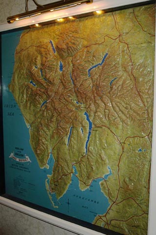
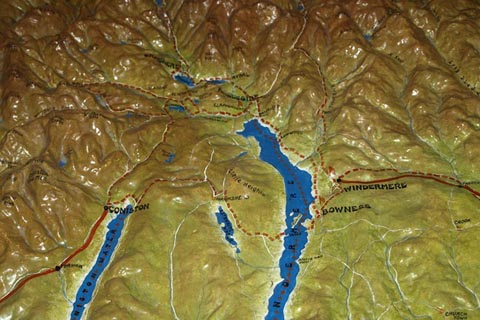
Relief map, plaster of paris etc, Model Map of the
English Lake District, scale 1 inch to 1 mile, made by
Exelby Reynolds, Shipley, Yorkshire, 1940s?
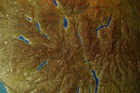
The vertical exageration is 3 times. The base map is dated 1913. Railways were grouped, forming the London Midland and Scottish Railway, LMS, in 1923. The 'Midland Region' came into existence as a part of nationalisation in 1948, Mr Reynolds died 1931, but this map could have been made by the surviving company. |
||

|
Reynolds 1920s | |
| map feature:- | table of symbols & north point & up is N & sea tinted & coast line & rivers & lakes & relief & solid relief & county & settlements & roads & railways | |
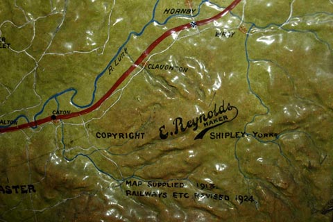
| inscription:- |
painted lower right
E. Reynolds / MAKER / COPYRIGHT SHIPLEY YORKS. / MAP SUPPLIED 1913. / RAILWAYS ETC REVISED 1924. |
|
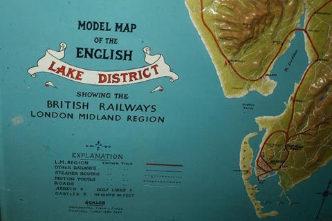
| inscription:- |
painted lower left
MODEL MAP / OF THE / ENGLISH / LAKE DISTRICT / SHOWING THE / BRITISH RAILWAYS / LONDON MIDLAND REGION |
|
| scale:- | 1 to 63360 ? (nominal) | |
|
||
|
||
|
||
|
||
|
||
|
|
notes | |