 Barrow Herald 1865

|

|
|
|
item:- Carlisle Library : Map 89 image:- © Carlisle Library |
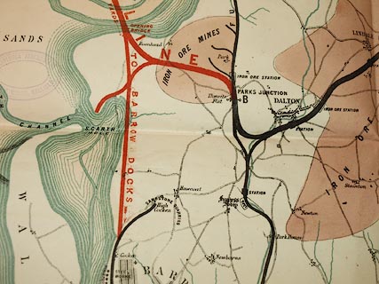
click to enlarge | |
| Illustration of part of map only. | ||
|
Railway map, colour lithograph, Furness Railway, scale
about 1.5 inches to 1 mile, lithograph by Malby and Sons,
published by the Barrow Herald, Barrow-in-Furness,
Cumberland, 1865.
There is tabulated data comparing distances by Furness Railway, and the Whitehaven and Furness Junction Railway. |
||

|
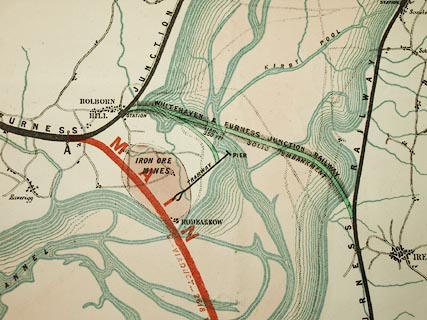
Barrow Herald 1865 | |
| map feature:- | sea tinted & coast form lines & rivers & settlements & roads & railways | |
| inscription:- |
printed lower left
PRESENTED / WITH THE / BARROW HERALD / OF SATURDAY, / MARCH 25, 1865. / FURNESS RAILWAY |
|
| inscription:- |
printed bottom right
Malby & Sons Lith. |
|
| inscription:- |
printed with scale line
SCALE OF MILES |
|
| scale line:- | 3+1 miles = 152.1 mm | |
| wxh, sheet:- | 66.5x68.5cm | |
| wxh, map:- | 603x642mm | |
| scale:- | 1 to 42000 ? (1 to 42323 from scale line, assuming a statute mile) | |
|
image:- © Carlisle Library |
|
|
| Illustration of part of map only. | ||