 Walker 1831

|

|
|
|
item:- Carlisle Library : Map 72 image:- © Carlisle Library |
click to enlarge |
|
|
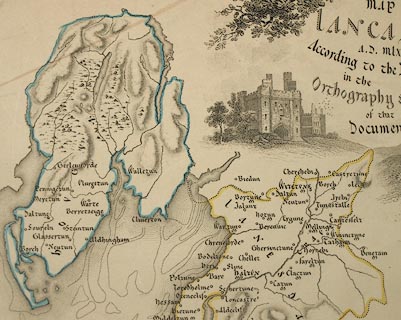
Map, hand coloured engraving, Map of Lancashire AD
mlxxxvi According to the Doomsday Survey, scale about 6.5
miles to 1 inch, by Walker, 1831.
|
||

|
Walker 1831 | |
| map feature:- | compass rose & up is N & scale line & lat and long scales & sea plain & coast form lines & rivers & lakes & relief & hill hachuring & woods & county & hundreds & settlements | |
| inscription:- |
printed upper right
MAP OF / LANCASHIRE / A.D. mlxxxvi / According to the Doomsday Survey / in the / Orthography & Character / of that / Document |
|
| scale line:- | 10 miles = 39.8 mm | |
| wxh, map:- | 226x362mm | |
| scale:- | 1 to 400000 ? (1 to 404358 from scale line, assuming a statute mile) | |