 Robins 1818

|

|
|
|
item:- private collection (92) image:- © see bottom of page |
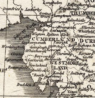
click to enlarge |
|
|
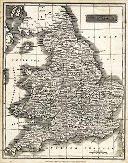
Map, uncoloured engraving, England and Wales, scale about
45 miles to 1 inch, engraved by Neele, published by J Robins
and Co, Albion Press, London, 1820.
|
||

|
Robins 1818 | |
| map feature:- | plain cartouche & up is N & scale line & lat and long scales (conical projection, W from Greenwich) & lat and long grid & sea plain & coast shaded & rivers & relief & hill hachuring & county & settlements & | |
| inscription:- |
printed title cartouche, upper right
ENGLAND & WALES |
|
| inscription:- |
printed bottom, right, centre
Neele sc. / Published by J. Robins & Co. Albion Press, London, January 1st. 1820. |
|
| inscription:- |
printed above scale line
British Miles |
|
| scale line:- | 50 miles = 28.4 mm | |
| scale:- | 1 to 2800000 ? (1 to 2833352 from scale line) | |
| wxh, sheet:- | 21.5x26.5cm | |
| wxh, map:- | 199x250mm | |
|
||