 Drayton 1612/1622

|

|
|
|
item:- JandMN (168) image:- © see bottom of page |
click to enlarge |
|
|
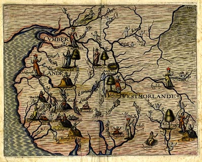
Map, hand coloured engraving, Cumberlande and
Westmorlande, by Michael Drayton, probably engraved by
William Hole, scale about 4 or 5 miles to 1 inch, published
by John Mariott, John Grismand, and Thomas Dewe, London,
1622.
The map is a sketch map, not to scale. Included in A Chorographicall Description of ... Great Britain, better known as Poly Olbion. |
||

|
Drayton 1612/1622 | |
| map feature:- | up is N & sea moire effect & coast shaded & rivers & lakes & forests & relief & hillocks & county | |
| inscription:- |
printed upper right
161 |
|
| scale:- | 1 to 250000 ? (crude estimate) | |
| wxh, sheet:- | 33.5x27.5cm | |
| wxh, map:- | 309x242mm | |
|
|
notes | |