 Bartholomew c1900

|

|
|
|
item:- JandMN (153) images:- © see bottom of page |
|
|
|
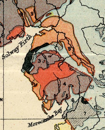
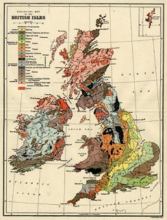
Geological map, colour printed, Geological Map of the
British Isles, scale about miles 63 to 1 inch, by John
Bartholomew, Edinburgh, about 1900?
|
||

|
Bartholomew c1900 | |
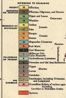
| map feature:- | up is N & scale line & lat and long scales (conical projection) & lat and long grid & sea plain & coast line & rivers & geology & stratigraphical column | |
| inscription:- |
printed upper left
GEOLOGICAL MAP / OF THE / BRITISH ISLES |
|
| scale line:- | 100 miles = 40.6 mm | |
| scale:- | 1 to 4000000 ? (1 to 3963901 from scale line) | |
| wxh, sheet:- | 24.5x32cm | |
| wxh, map:- | 223x294mm | |
|
||
|
||
|
|
notes | |