 Pigot 1835

|

|
|
|
item:- Armitt Library : ALMC2008.14.41 image:- © see bottom of page |
click to enlarge |
|
|
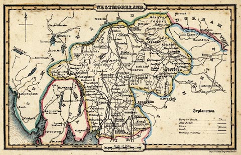
Map, hand coloured engraving, Westmoreland ie
Westmorland, scale about 10 miles to 1 inch, engraved by
Pigot and Slater, Manchester, published by Pigot and Co,
Manchester and London, about 1835.
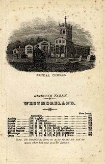
Included in A Pocket Topography and Gazetteer of England. The accompanying page has an engraving of Holy Trinity Church, Kendal, and a table of distances for the county. |
||

|
Pigot 1835 | |
| map feature:- | plain cartouche & north point & up is N & scale line & lat and long scales (rectangular projection? the longitude scale jumps 5 minutes across the piece hidden by cartouches) & table of symbols (includes railroads) & sea plain & coast form lines & rivers & lakes & forests & county & settlements & roads (turnpike roads) & canals | |
| inscription:- |
printed title cartouche, top
WESTMORELAND. |
|
| inscription:- |
printed bottom right
Pigot & Slater, Engravers, Manchr. |
|
| inscription:- |
printed above scale line
Scale of Miles. |
|
| scale line:- | 10 miles = 25.9 mm | |
| longitude, Kendal:- | 2d 55m W (?) | |
| wxh, sheet:- | 12.5x19.5cm | |
| wxh, map:- | 165x104mm | |
| scale:- | 1 to 620000 ? (1 to 621368 from scale line assuming a statute mile) | |
|
||
|
|
notes | |