 Aikin 1790

|

|
|
|
item:- Armitt Library : ALMC2008.14.25 image:- © see bottom of page |
click to enlarge |
|
|
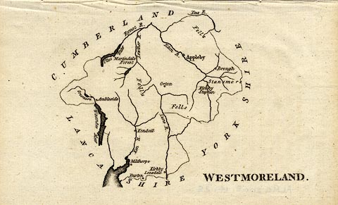
Map, uncoloured engraving, Westmoreland ie Westmorland,
scale about 8.5 miles to 1 inch, by John Aikin, London,
1790.
Included in an atlas, England Delineated; or, a Geographical Description of every county in England and Wales, by J. Aikin, 2nd edn 1790 or later. |
||

|
Aikin 1790 | |
| map feature:- | up is N & coast line & coast form lines & rivers & lakes & (no relief, but two 'Fells' labelled) & forests (no tree symbols, a forest labelled) & county & settlements | |
| inscription:- |
printed lower right
WESTMORELAND. |
|
| wxh, sheet:- | 19x12cm | |
| wxh, map:- | 12x11cm | |
| scale:- | 1 to 540000 ? (rough estimate) | |