 Camden 1607 map

|

|
|
|
item:- Armitt Library : ALMC2008.14.7 image:- © see bottom of page |
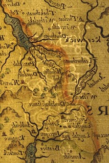
click to enlarge |
|
|
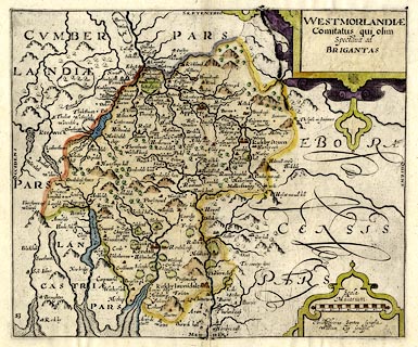
Map, hand coloured engraving, Westmorlandiae ie
Westmorland, scale about 3.5 miles to 1 inch, by Christopher
Saxton, engraved by William Kip, about 1607 edn 1610 or
1627?
Originally engraved for Britannia by William Camden, the last Latin edition, 6th edn 1607, this impression of the map is from an English edition of Britannia, published 1610 onwards. The reverse of the map is blank. |
||

|
Camden 1607 map | |
| map feature:- | strapwork cartouche & swash lettering & labelled borders (Latin) & up is N & scale line & sea stippled & coast shaded & rivers & lakes & relief & hillocks & woods & forests & parks & county & settlements | |
| inscription:- |
printed title cartouche, upper right
WESTMORLANDIAE / Comitatus qui olim / Spectavit ad / BRIGANTAS |
|
| inscription:- |
printed above scale line
Scala Miliarium |
|
| inscription:- |
printed below scale line, lower right
Christophorus Saxton scripsit / William Kip sculpsit |
|
| inscription:- |
water mark:
crown etc |
|
| scale line:- | 8 miles = 55.5 mm | |
| wxh, sheet:- | cm | |
| wxh, plate:- | mm | |
| wxh, map:- | mm | |
| scale:- | 1 to 230000 ? (1 to 231978 from scale line wrongly assuming a statute mile) | |
|
||