 Bowen 1720

|

|
|
|
item:- private collection (1_271) image:- © see bottom of page |
click to enlarge |
|
|
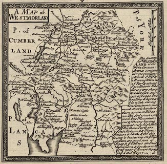
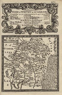
Map, county map, pl.271, A Map of Westmorland, published
by Emanuel Bowen, St Katherines, London, 1720.
The map has a descriptive text for Westmorland, and the title cartouche for The Roads from York to Whitby and Scarboro'. Published in Britannia Depicta Or Ogilby Improv'd, with text by John Owen, by Emanuel Bowen from 1720 to after 1764. |
||

|
Bowen 1720 | |
| map feature:- | picture frame border & plain cartouche & up is N & scale line & rivers & bridges & relief & hillocks & county & settlements & roads & descriptive text | |
| inscription:- |
printed title cartouche, upper left
A MAP of / WESTMORLAND |
|
| scale line:- | 10 miles = 32.5 mm | |
| wxh, map:- | 116x114mm | |
| scale:- | 1 to 500000 ? (1 to 495000 from scale line) | |
|
||
|
|
notes | |