 OS 1900

|

|
|
|
item:- JandMN (134) image:- © see bottom of page |
click to enlarge |
|
|
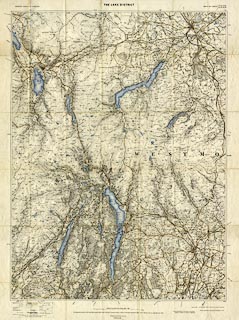
Map, colour lithograph? The Lake District, scale 1 mile
to 1 inch, published by the Ordnance Survey, Southampton,
Hampshire, 1900.
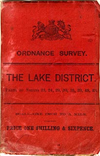
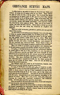
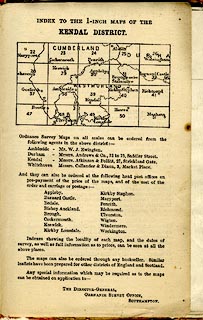
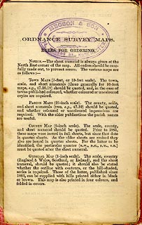
The map uses parts of existing One Inch map sheets 23, 24, 29, 30, 38, 39, 48, and 49, revised to 1896. There are three pages of matter advertising Ordnance Survey maps inside the covers, about maps at 1 inch, 6 inch, 25 inch and 5 feet to 1 mile. There is an index sheet for the one inch sheets in the Kendal district and a note of local agents - W J Ewington, Ambleside; Atkinson and Pollitt, 27 Strickland Gte, Kendal; Callander and Dixon, 3 Market Place, Whitehaven; etc. |
||

|
OS 1900 | |
| map feature:- | folded (6x7) & card cover & index map & table of symbols & up is N & scale line & lat and long scales & rivers & bridges & relief & contours & spot heights & woods & forests & county & settlements & roads & railways & canals | |
| inscription:- |
printed cover
ORDNANCE SURVEY. / THE LAKE DISTRICT. / PARTS OF SHEETS 23, 24, 29, 30, 38, 39, 48, 49. / SCALE ONE ONCH TO A MILE. / PRICE ONE SHILLING & SIXPENCE. black on red; royal coat of arms |
|
| inscription:- |
printed top, left, centre and right
ORDNANCE SURVEY OF ENGLAND / THE LAKE DISTRICT / PARTS OF SHEETS 23, 24, 29, 30, 38, 39, 48, 49 |
|
| inscription:- |
printed above scale line
Scale of One Inch to One Statute Mile - 1/63360 |
|
| scale line:- | 4+1 miles = 127.4 mm | |
| inscription:- |
printed bottom
The Altitudes are given in Feet above the assumed Mean Sea Level at Liverpool, which is 0.650 of a Foot below the general Mean Level of the Sea ... |
|
| scale:- | 1 to 63360 ? (nominal) | |
| map, sheet:- | 65x86.5cm | |
| wxh, map:- | 567x766mm | |
| wxh, folded:- | 9.5x15cm | |
| wxh, cover:- | 10.5x16cm | |
|
||
|
||
|
||
|
||