 Baedeker 1927 map 1

|

|
|
|
item:- JandMN (68_2) image:- © see bottom of page |
click to enlarge |
|
|
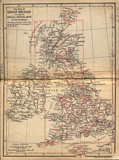
Map, Key Map of Great Britain, scale about 95 miles to 1
inch, by Wagner and Debes Geographical Establishment,
Leipzig, Germany, 1927?
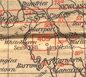
Printed on the end papers of Baedeker's Great Britain, 8th edn 1927. The map has detail map areas outlined and numbered with the page where they are tipped in the guide book; and has the routes as numbered in the guide book. For Westmorland, Cumberland, etc, these are routes 50-52, and the map at p.405. |
||

|
Baedeker 1927 map 1 | |
| inscription:- |
printed upper left
Key Map of / GREAT BRITAIN / showing the / ROUTES & SPECIAL MAPS / of the Handbook. |
|
| scale line:- | 100 miles = 26.8 mm | |
| scale:- | 1 to 6000000 ? (1 to 6005015 from scale line) | |
| wxh, map:- | 147x199mm | |
|
||