 Bowen 1720

|

|
|
|
item:- Dove Cottage : 2007.38.100 image:- © see bottom of page |
click to enlarge |
|
|
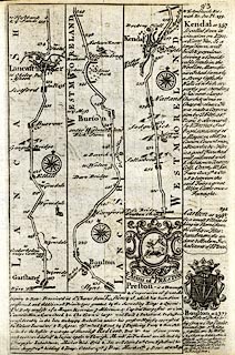
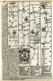
Strip maps, uncoloured engravings, road maps, The Road
from London to Carlisle, scale about 2 miles to 1 inch, with
sections in Lancashire and Westmorland, published by Emanuel
Bowen, St Katherines, London, 1720.
pl.93 from Garstang and Lancaster, Lancashire; through Burton, to past Kendal, Westmorland; The map also has the coat of arms and descriptive text for Preston and Bolton, and descriptive text for Carlton and Kendal. pl.94 from just north of Kendal, through Shap and Thrumby, Westmorland; then Penrith to Carlisle, Cumberland; The map also has the descriptive text for Penrith, and coat of arms and descriptive text for Newton. From Britannia Depicta Or Ogilby Improv'd, with text by John Owen, from 1720 to after 1764. |
||

|
Bowen 1720 | |
| map feature:- | compass rose & up is destination & rivers & relief & hillocks & county & settlements & roads & descriptive text & coat of arms | |
| wxh, sheet:- | 14.5x19cm | |
|
||
|
|
notes | |
|
|
notes | |