 Hall 1820

|

|
|
|
item:- Dove Cottage : 2007.38.56 image:- © see bottom of page |
click to enlarge |
|
|
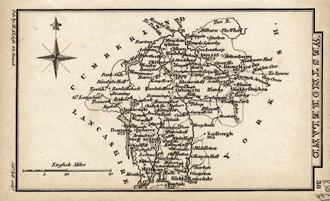
Map, uncoloured engraving, Westmoreland ie Westmorland,
scale about 14.5 miles to 1 inch, by Sidney Hall, London,
1820, published by Samuel Leigh, 18 Strand, London, 1820-31.
The map is published sideways on page 38 of Leigh's New Atlas of England and Wales. |
||

|
Hall 1820 | |
| map feature:- | plain cartouche & compass rose & up is N & scale line & coast shaded & rivers & lakes & parks & county & settlements & roads | |
| inscription:- |
printed top of page, side of map
WESTMORELAND / 38 |
|
| inscription:- |
printed bottom of page, side of map, left and right
Pub. by S. Leigh, 18, Strand. / Sidy. Hall sculpt. |
|
| scale line:- | 20 miles = 35.0 mm | |
| wxh, sheet:- | 8.5X14cm | |
| wxh, map:- | 121X72mm | |
| scale:- | 1 to 920000 ? (1 to 919625 from scale line assuming a statute mile) | |