 Dispatch 1863

|

|
|
|
item:- Dove Cottage : 2007.38.37 image:- © see bottom of page |
click to enlarge |
|
|
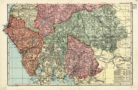
Map, colour lithograph, Cumberland S and Westmorland,
part of Cumberland and Westmorland, scale about 3.5 miles to
1 inch, first drawn by Edward Weller for the Weekly Dispatch
newspaper, 1856-62, published by G W Bacon, Bacon's
Geographical Establishment, London, 1895-97.
Plate 10 in the Commercial and Library Atlas of the British Isles. Most of Lancashire north of the sands is shown; railways are a prominent feature. Version of this map were published from 1850s to 1930s. |
||

|
Dispatch 1863 | |
| map feature:- | up is N & scale line & lat and long scales (trapezoidal projection) & index grid (1..11, G..N) & table of symbols & table of data (population) & sea tinted & coast tinted & rivers & lakes & relief & hill hachuring & parks & county & electoral data & settlements & roads & canals & railways | |
| inscription:- |
printed top right
CUMB. S. & WESTM. 10 |
|
| inscription:- |
printed bottom left
Bacon's Geographical Establishment |
|
| inscription:- |
printed above scale line
British Statute Miles |
|
| scale line:- | 10 miles = 76.2 mm | |
| scale:- | 1 to 210000 ? (1 to 211200 from scale line) | |
| wxh, sheet:- | 52.5x34.5cm | |
| wxh, map:- | 462x310mm | |