 Camden 1607 map

|

|
|
|
item:- Dove Cottage : 2007.38.11 image:- © see bottom of page |
click to enlarge |
|
|
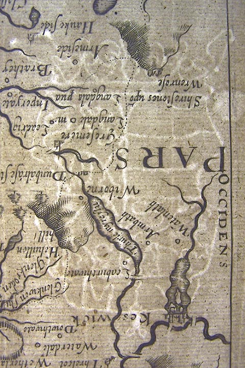
Map, uncoloured engraving, Westmorlandiae ie Westmorland,
scale about 3.5 miles to 1 inch, by Christopher Saxton,
engraved by William Kip, about 1607.
Included in Britannia by William Camden, the last Latin edition, 6th edn 1607. |
||

|
Camden 1607 map | |
| map feature:- | strapwork cartouche & swash lettering & labelled borders (Latin) & up is N & scale line & sea stippled & coast shaded & rivers & lakes & relief & hillocks & woods & forests & parks & county & settlements | |
| inscription:- |
printed title cartouche, upper right
WESTMORLANDIAE / Comitatus qui olim / Spectavit ad / BRIGANTAS |
|
| inscription:- |
printed above scale line
Scala Miliarium |
|
| inscription:- |
printed below scale line, lower right
Christophorus Saxton scripsit / William Kip sculpsit |
|
| inscription:- |
water mark:
[M V] coat of arms, crown |
|
| wxh, sheet:- | 39x33.5cm | |
| wxh, plate:- | 314x266mm | |
| wxh, map:- | 311x263mm | |
| scale:- | 1 to 230000 ? (estimate) | |