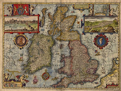
 Speed 1611

|

|
|
|
item:- private collection (85) image:- © see bottom of page |
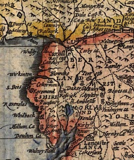
click to enlarge |
|
|
Map, hand coloured engraving, Kingdome of Great Britaine
and Ireland, scale about 36 miles to 1 inch, by John Speed,
about 1610-11, published by Thomas Bassett, Fleet Street and
Richard Chiswell, St Paul's Churchyard, London, 1676?
The map has been coloured at a late date, very badly, probably using the wrong sort of paints with heavy pigments and too clumsy a brush and hand. |
||

|
Speed 1611 | |
| map feature:- | strapwork cartouche & vignettes (London and Edinburgh) & coat of arms, royal (Stuart period, 1603-85) & beasts & inset map (Orkney) & compass rose & up is N & labelled borders & lat and long scales & lat and long grid & scale line & sea plain & swash lettering & coast shaded & sea monsters & galleons & relief & rivers & bridges & woods & forests & trees & country & county & settlements | |
| inscription:- |
printed title cartouche
THE KINGDOME OF GREAT / BRITAINE AND IRELAND / by I. Speed. |
|
| inscription:- |
printed lower right
Are to be sold by Tho : Bassett / in Fleet street and Ric : Chiswell / in St. Pauls Churchyard. |
|
| inscription:- |
printed lower left above scale line
Common : Mill. |
|
| scale line:- | 80 miles = 57.1 mm | |
| wxh, sheet:- | 56x44cm | |
| wxh, plate:- | 517x388mm | |
| wxh, map:- | 512x383mm | |
| scale:- | 1 to 2300000 ? (1 to 2254773 from scale line wrongly assuming modern mile) | |
|
||
|
|
notes | |