 Balderston c1890 map

|

|
|
|
item:- private collection (27_1) image:- © see bottom of page |
click to enlarge |
|
|
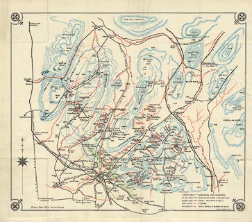
Map, the hills in the Ingleton area, probably by Robert R
Balderston, engraved by Goodall and Suddick, Leeds, West
Yorkshire, about 1890.
Tipped in opposite p.1 of Ingleton, Bygone and Present, by Robert R and Margaret Balderston, published about 1890. |
||

|
Balderston c1890 map | |
| map feature:- | compass rose & up is N & table of symbols & rivers & relief & hill hachuring & settlements & roads & railways & caves | |
| inscription:- |
printed lower right
Goodall & Suddick. Leeds. |
|
| scale:- | 1 to 63360 ? (nominal) | |
| wxh, sheet:- | 40.5x36.5cm | |
| wxh, map:- | 361x305mm | |
|
|
notes | |