 Camden 1607 map

|

|
|
|
item:- Dove Cottage : 2007.38.13 image:- © see bottom of page |
click to enlarge |
|
|
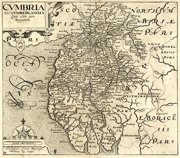
Map, uncoloured engraving, Cumbria or Cumberlandia ie
Cumberland, scale about 5 miles to 1 inch, by Christopher
Saxton, engraved by William Kip, about 1607.
Included in Britannia by William Camden, the last Latin edition, 6th edn 1607; probably from a later edn, 1637. |
||

|
Camden 1607 map | |
| map feature:- | strapwork cartouche & swash lettering & compass rose & up is N & scale line & sea stippled & coast shaded & rivers & lakes & relief & hillocks & woods & forests & parks & county & settlements | |
| inscription:- |
printed title cartouche, upper left
CUMBRIA / Sive CUMBERLANDIA / Qua olim pars / Brigantum |
|
| inscription:- |
printed below scale line
Scala Miliarium |
|
| inscription:- |
printed below scale line, lower left
Christophorus Saxton Descripsit / Wilhelmus Kip Sculpsit |
|
| inscription:- |
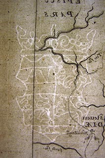
water mark:
[A N / 1627] coat of arms and crown |
|
| scale line:- | 10 miles = 50.0 mm | |
| wxh, sheet:- | 39x33cm | |
| wxh, plate:- | 326x289mm (?) | |
| wxh, map:- | 324x287mm | |
| scale:- | 1 to 320000 ? (1 to 321869 from scale line wrongly assuming a statute mile) | |
|
||