button to main menu Paterson 1785

item:-
private collection (19_103)
image:-
©  see bottom of page
image, button to large image
click to enlarge


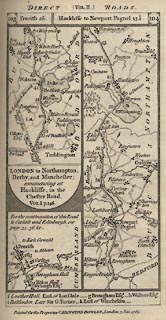
Strip map, part of London to Carlisle by Coventry and Warrington, and the start of London to ... Manchester, scale about 3 miles to 1 inch, by Captain Daniel Paterson, published by Carington Bowles, 69 St Paul's Churchyard, London, 1785.
Plate 103/104 in Paterson's British Itinerary, vol.2, by Captain Daniel Paterson, published by Carington Bowles, London, 1785.
From Westmorland; to Penrith, Cumberland. AND the start of a new road.
   Paterson 1785
map feature:- north point & up is destination & rivers & county & settlements & roads & road distances & distances from London
inscription:- printed top
DIRECT (VOL.II.) ROADS.
inscription:- printed cartouche at top
103 / Penrith 26. / Hockliffe to Newport Pagnel 13 1/4. / 104
inscription:- printed bottom
Printed for the Proprietor CARINGTON BOWLES, London, 3 Jan. 1785.
wxh, sheet:- 11x18.5cm
wxh, map:- 86x161mm
scale:- 1 to 190000 ? (guess)
   notes