 Simons 1635

|

|
|
|
item:- private collection (50_39) image:- © see bottom of page |
click to enlarge |
|
|
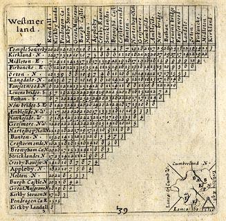
Table of distances, uncoloured engraving, Westmerland ie
Westmorland, with a thumbnail map, scale about 42 miles to 1
inch, by Mathew Simons, published in A Direction for the
English Traviller, 1635.
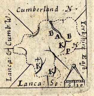
The county map is in the bottom right part of the page, below and beside the triangular distance table. |
||

|
Simons 1635 | |
| map feature:- | up is N & scale line & rivers & settlements & county | |
| scale line:- | 10 miles = 6.1 mm | |
| inscription:- |
printed top left of table
Westmer / land |
|
| wxh, sheet:- | 18.5x14.5cm | |
| wxh, plate:- | 102x101mm | |
| wxh, map:- | 25x26mm | |
| scale:- | 1 to 2600000 ? (1 to 2640000 from scale line wrongly assuming statute mile) | |
|
||
|
|
notes | |