 Dispatch 1863

|

|
|
|
item:- JandMN (98) image:- © see bottom of page |
click to enlarge |
|
|
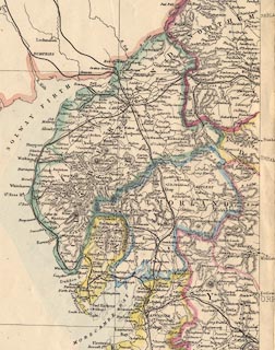
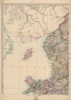
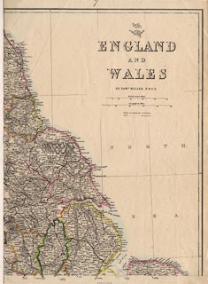
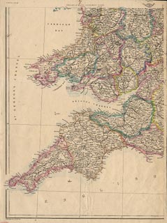
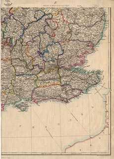
Map, England and Wales, scale about 13 miles to 1 inch,
drawn and engraved by Edward Weller, Duke Street,
Bloomsbury, London, 1863.
Published on 4 sheets in the Dispatch Atlas, issued in parts with the Weekly Dispatch over the period 1856-62. |
||

|
Dispatch 1863 | |
| map feature:- | up is N & scale line & lat and long scales & lat and long grid & sea plain & coast line & rivers & relief & hill hachuring & county & settlements & roads & railways & canals | |
| inscription:- |
printed upper right (NE sheet)
ENGLAND / AND / WALES / BY EDWD. WELLER, F.R.G.S. Mercury; part of a globe |
|
| inscription:- |
printed bottom left and right (SW and SE sheets)
Weekly Dispatch Atlas, 139, Fleet Street. / Ebngraved by Edwd. Weller, Duke Strt. Bloomsbury. |
|
| scale line:- | 50 miles = 95.8 mm | |
| scale:- | 1 to 840000 ? (1 to 839950 from scale line) | |
| wxh, map:- | 628x843mm (roughly) | |
|
||
|
||
|
||
|
||