 Cary 1789

|

|
|
|
item:- Hampshire Museums : FA1999.5.50 image:- © see bottom of page |
click to enlarge |
|
|
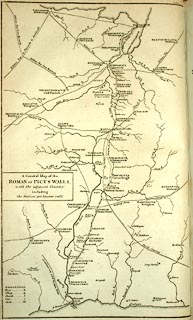
Map, General Map of the Roman or Picts Walls, ie
Hadrian's Wall in Cumberland and Northumberland, and
Scotland, probably by engraved John Cary for Richard Gough,
about 1789.
Tipped in between pp.228/229 in vol.3 of Camden's Britannia, translation with additional material by Richard Gough, published London, 1789. Camden 1789 (Gough Additions) has:- 'For the better representing the present appearance of the ruins of the wall, we have copied Mr. Horsley's general map of the whole wall, which will be found to comprehend all the castella on it expressed in his particular maps of the parts of it upon a larger scale, as well as to represent the course of Hadrian's vallum and its parallellism with that of Severus. The former is marked by the fainter line accompanying the latter expressed by the blacker line.' |
||

|
Cary 1789 | |
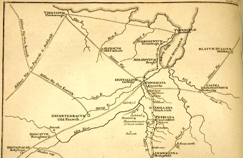
| map feature:- | plain cartouche & up is W & table of symbols & sea plain & coast form lines & rivers & settlements & roman roads & archaeology | |
| inscription:- |
printed title cartouche, middle right
A General Map of the / ROMAN or PICTS WALLS, / with the adjacent Country / including / the stations per lineam valli. |
|
| wxh, map:- | 25x41cm (approx) | |
|
||