 Bacon 1910s

|

|
|
|
item:- JandMN (81) image:- © see bottom of page |
click to enlarge |
|
|
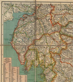
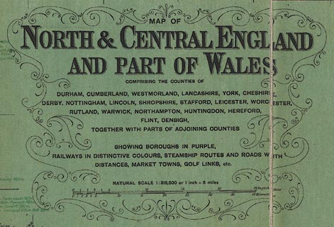
Map, colour lithograph, North and Central England and
Part of Wales, scale about 5 miles to 1 inch, by G W Bacon
and Co, Norwich Street, Fetter Lane, London, published by
British Geographical Publishing Co, Royal London Buildings,
Manchester, 1910s?
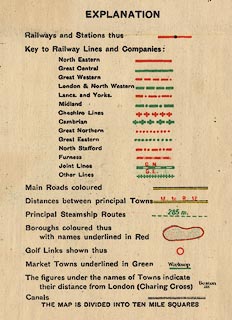
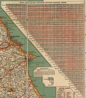
There are: an Index Gazetteer of places refering to positions using an index grid of ten miles squares, and giving population, market day, and early closing day; table of speed limits in towns, mostly 10 mph; a triangular table of distances, 'aerial' presumably meaning crowflight, and by rail; and a table of Motor Marks, ie vehicle licence letters. |
||

|
Bacon 1910s | |
| map feature:- | sectioned for folding & mounted & folded & card cover & table of symbols & up is N & scale line & index grid & table of data & sea tinted & coast line & rivers & lakes & relief & hill hachuring & county & settlements & roads & railways & canals & shipping routes & table of distances | |
| inscription:- |
printed upper right
MAP OF / NORTH & CENTRAL ENGLAND / AND PART OF WALES / ... |
|
| inscription:- |
printed bottom left and right
COPYRIGHT. G.W. BACON & CO. LTD., NORWICH ST, FETTER LANE, LONDON E.C.4. / Published by BRITISH GEOGRAPHICAL PUBLISHING CO., ROYAL LONDON BUILDINGS, MANCHESTER. |
|
| inscription:- |
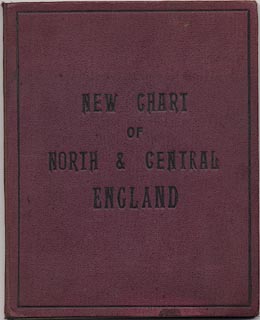
printed cover
NEW CHART / OF / NORTH AND CENTRAL / ENGLAND black on brown |
|
| scale line:- | 25 miles = 125.8 mm | |
| scale:- | 1 to 320000 ? (1 to 319822 from scale line) | |
| wxh, sheet (including gaps):- | 96.5x123.5cm | |
| wxh, map (including gaps):- | 940x1188mm | |
| wxh, folded:- | 21x25cm | |
|
||
|
||
|
||
|
||