 Aikin 1790

|

|
|
|
item:- JandMN (145) image:- © see bottom of page |
click to enlarge |
|
|
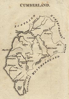
Map, uncoloured engraving, Cumberland, by John Aikin,
London, 1790.
Published in an atlas, England Delineated; or, a Geographical Description of every county in England and Wales, by J. Aikin, 2nd edn 1790 or later. |
||

|
Aikin 1790 | |
| map feature:- | up is N & coast line & coast form lines & rivers & lakes & relief & hillocks (just Skiddaw, and two 'Fells' labelled) & county & settlements | |
| inscription:- |
printed top
CUMBERLAND. |
|
| wxh, sheet:- | 12x18.5cm | |
| wxh, map:- | 11x15.5cm | |