 Baedeker 1927 map 1

|

|
|
|
item:- JandMN (68_1) image:- © see bottom of page |
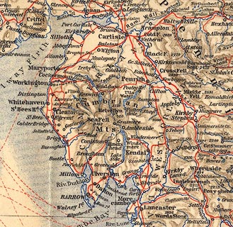
click to enlarge |
|
|
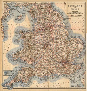
Map, with railways, England and Wales, scale about 23
miles to 1 inch, by Wagner and Debes Geographical
Establishment, Leipzig, Germany, about 1927?
Folded, tipped in before the title page, in Baedeker's Great Britain, 8th edn 1927; the map might date from the 1st edn, 1887. |
||

|
Baedeker 1927 map 1 | |
| map feature:- | up is N & scale lines & lat and long grid & lat and long scales & table of symbols & sea plain & coast line & coast tinted & rivers & relief & hill shading & county & settlements & railways & canals & shipping routes | |
| inscription:- |
printed upper right
ENGLAND / AND / WALES |
|
| scale line:- | 50 miles = 54.2 mm | |
| scale:- | 1 to 1500000 ? (1 to 1484635 from scale line) | |
| wxh, sheet:- | 38.5x40.5cm | |
| wxh, map:- | 366x384mm | |
|
||