 Senex 1719-57

|

|
|
|
item:- Hampshire Museums : FA1999.23 image:- © see bottom of page |
click to enlarge |
|
|
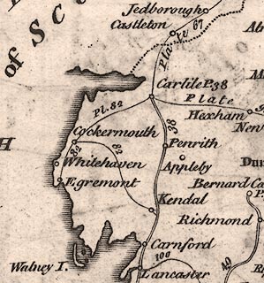
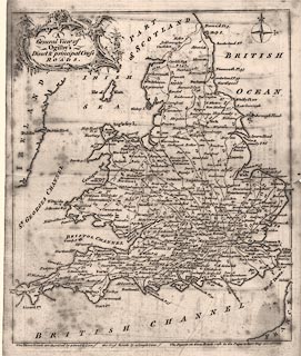
Road map, uncoloured engraving, scale about 50 miles to 1
inch, General View of Ogilby's Direct and Principal Cross
Roads, in England and Wales; from a road book by John Senex,
1719, edition printed for John Bowles and Son, The Black
Horse, Cornhill, London, after 1757.
From Roads through England Delineated; ... Ogilby's survey revised, improved and reduced to a size portable for the pocket. The map of England and Wales has numbers against each route referring to plate numbers; it is an index map. Note - the plate number is at top left and right, the map is double sided; the general map has no number. |
||

|
Senex 1719-57 | |
| map feature:- | baroque cartouche & compass rose (cardinal points, fleur de lys for N and cross for E) & coast shaded & settlements & roads (double line for direct, single line for cross roads) | |
| inscription:- |
printed title cartouche
A / General View of / Ogilby's / Direct & principal Cross / ROADS. |
|
| wxh, sheet:- | 23.5x18cm | |
| scale:- | 1 to 3200000 ? (approx) | |
|
||