 Cary 1789

|

|
|
|
item:- Hampshire Museums : FA1999.5.2 image:- © see bottom of page |
click to enlarge |
|
|
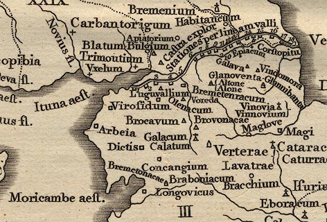
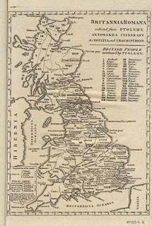
Map, uncoloured engraving, Britannia Romana ie Roman
Britain, probably by John Cary, London, 1789.
The map shows british tribal areas keyed to a table of tribes by roman numbers; eg II near the head of the Test/Anton is the Belgae; the map is accompanied by a table of place names keyed to the map by a grid A..V, b..n. Facing vol.1 p.LXXXIV in Britannia by William Camden, 1586, translated from Latin by Richard Gough, published London, 1789. |
||

|
Cary 1789 | |
| inscription:- |
BRITANNIA ROMAN / collected from PTOLEMY, / ANTONINES ITINERARY, / the NOTITIA, and INSCRIPTIONS. |
|
| wxh, map:- | 24x34.5cm | |
|
||