 Bacon 1895

|

|
|

|
back to object record | |
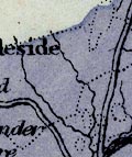
| Bacon 1895 Geology, Longsleddale | ||
|
Notes about Longsleddale from a Geological Map of England
and Wales, scale about 18 miles to 1 inch, published in the
Commercial and Library Atlas of the British Isles from the
Ordnance Survey, by G W Bacon and Co, Strand, London, 1895.
|
||
|
||
|
|
||
| scale |
The map scale is about:-
1 to 1100000 ? 18 miles to 1 inch |
|
|
Places identified:-
|
||
|
Not much is identified on this small scale map; and the
geology is inaccurate.
|
||
Lakes Guides menu.