 Backhouse 1773

|

|
|

|
back to object record | |
| Map Features | ||
|
The notes are biased towards an interest in Westmorland and
Cumberland. Note that this a thematic map that does not show
more than necessary supporting topography.
|
||
|
|
||
| title |
Printed in a foliage cartouche upper left:-
A MAP of the MEETINGS, belonging to the QUARTERLY MEETINGS of LANCASTER, WESTMORELAND, CUMBERLAND, NORTHUMBERLAND, DURHAM & YORK. By James Backhouse, 1773 / Engraved by Thos. Kitchin. Printed at the bottom:- Publish'd as the Act Directs 1st. 3d. Moth. 1773, by the Author at DARLINGTON, Price 1s. 6d., also sold by T. Kitchin, No.59, Holborn Hill, London. |
|
|
|
||
|
table of symbols
meeting days market days |
Printed upper left is an:-
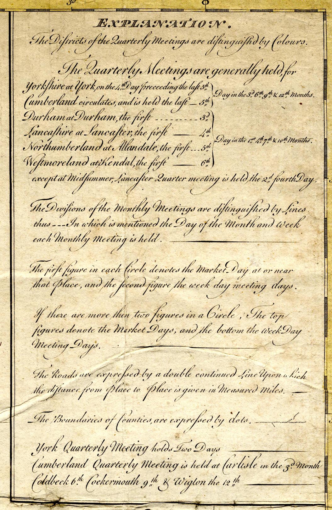
EXPLANATION. The Districts of the Quarterly Meetings are distinguished by Colours. The Quarterly Meetings are generally held, for Yorkshire at York, on the 4th. Day preceding the last ... 5th. Day in the 3d. 6th. 9th. & 12th. Months. Cumberland circulates, and is held the last ... 5th. -- ditto -- Durham at Durham, the first ... 3d Day in the 1st. 4th. 7th. & 10th. Months. Lancashire at Lancaster, the first ... 4th -- ditto -- Northumberland at Allandale, the first ... 5th -- ditto -- Westmoreland at Kendal, the first ... 6th -- ditto -- except at Midsummer, Lancaster Quarter meeting is held the 2d. fourth Day. The Divisions of the Monthly Meetings are distinguished by Lines thus [dashed line] In which is mentioned the Day of the Month and Week each Monthly Meeting is held. The first figure in each Circle denotes the Market Day at or near that Place, and the second figure the week day meeting days. If there are more than two figures in a Circle. The top figures denote the Market Days, and the bottom the Week Day Meeting Days. The Roads are expressed by a double continued Line Upon which the distance from Place to Place is given in Measured Miles. The Boundaries of Counties are expressed by dots. [dotted line] York Quarterly Meeting holds Two Days Cumberland Quarterly Meeting is held at Carlisle in the 3d. Month Coldbeck 6th. Cockermouth 9th. & Wigton the 12th. Printed lower left is:- 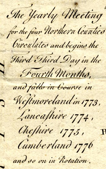
The Yearly Meeting for the four Northern Counties Circulates and begins the Third Third Day in the Fourth Months, and falls in Course in Westmoreland in 1773, Lancashire 1774, Cheshire 1775, Cumberland 1776 and so on in Rotation. |
|
|
|
||
| orientation |
The map is printed with North at the top.
|
|
|
|
||
| scale |
The map scale is estimated about:-
1 to 580000 9 miles to 1 inch |
|
|
|
||
|
lat and long scales
lat and long grid |
Printed in the map borders are scales of latitude and longitude for a ?slanted rectangular projection? chequered in 5 minute intervals, labelled at 30 minutes intervals. The bottom scale is labelled:- Longitude West from London From the scales the longitude, Kendal = 2d 51m W suggesting a prime meridian 6 degrees E of Greenwich, which is unlikely. The map has the hint of a latitude and longitude grid, a graticule. The lines are engraved in the surrounding areas, but not over the area of the map's interest. |
|
|
|
||
|
sea area
sea plain |
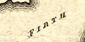
The sea area is plain. Some sea areas are labelled, eg:- IRISH SEA SOLWAY FIRTH |
|
|
|
||
|
coast line
coast form lines headlands foreshore sands |
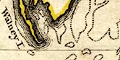
The coast line is emphasized by form lines. A headland is labelled in Cumberland:- Bees Head Foreshore sands are indicated by dotted outlines in the Solway Firth, Duddon Estuary, Morecambe Bay, etc. |
|
|
|
||
| rivers |
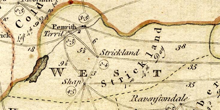
While river estuaries are clearly shown along the coasts, very few rivers are plotted - the Crake from Coniston water, the Eden at Carlisle, for example. Only one river in Cumberland is labelled, in its estuary:- Duddon R. |
|
|
|
||
| lakes |
Just three lakes are drawn by an outline with form lines, not labelled but recognizable:- Coniston water Ullswater Windermere lake |
|
|
|
||
| county |
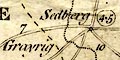
The prominent boundaries are of the meeting areas. Where these are not the same as the county boundary that is drawn by a dotted line, which is not tinted. For an example see the Westmorland Yorkshire boundary putting Sedbergh, Garsdale and Dent into Yorkshire, though they are part of the Westmoreland Quarterly Meeting. The county names appear on the map, but they are the Quarterly Meeting names. |
|
|
|
||
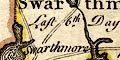
| settlements |
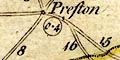
Settlements are not specifically shown on the map,but, of
course, appear as the places of meetings. For an instance of
how this could be misleading notice that Swarthmoor is
shown, but Ulverston is not.
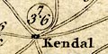
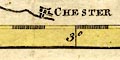
The places are marked by a circle. Where the place is more significant it may have added elements: a town like Kendal has block circle block; a city like Carlisle has blocks on a minimal street plan. |
|
|
|
||
|
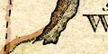
roads
sands roads road distances |
Roads and sands roads are drawn by a double line which joins meeting to meeting with little regard to topography. Distances from place to place, miles, are labelled by the roads. The roads are, of course, the regular roads, but are marked with meeting places in preference to the significant settlements along them. For example the Lancaster Carlisle Road goes:- from Lancaster, through Yealand, Lancashire; then Preston [Patrick], Kendal, Shap, Terril, Westmorland; Penrith, to Carlisle, Cumberland. Sands roads across Lancaster Sands and Leven sands are included. |
|
|
|
||
| meetings |
The meeting area boundaries are a dotted line tinted with a colour. Meetings are organized in a hierarchy: yearly, quarterly, monthly, and individual local meetings. The quarterly meetings carry county names, but are not necessarily coterminous with counties. |
|
Lakes Guides menu.