 Old Cumbria Gazetteer
 |
 |
|
| roman bridge, Willowford | ||
| Willowford Bridge | ||
| site name:- | Hadrian's Wall | |
| site name:- | Irthing, River | |
| locality:- | Willowford | |
| civil parish:- | Upper Denton (formerly Cumberland) | |
| civil parish:- | Waterhead (formerly Cumberland) | |
| county:- | Cumbria | |
| locality type:- | roman bridge | |
| locality type:- | bridge | |
| coordinates:- | NY62126645 | |
| 1Km square:- | NY6266 | |
| 10Km square:- | NY66 | |
|
|
||
| MN photo:- |
Abutment on the east of the river. |
|
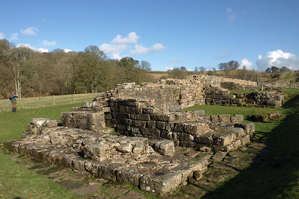 BUB48.jpg (taken 16.2.2011) 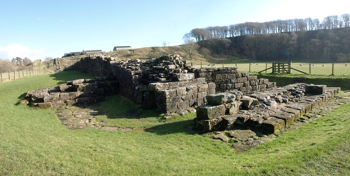 Click to enlarge BUB47.jpg (taken 16.2.2011) |
||
|
|
||
| evidence:- | old text:- Camden 1789 (Gough Additions) |
|
| source data:- | Book, Britannia, or A Chorographical Description of the Flourishing Kingdoms of England,
Scotland, and Ireland, by William Camden, 1586, translated from the 1607 Latin edition
by Richard Gough, published London, 1789. goto source goto sourcePage 226, Mr Horsley:- "..." ""At the Willoford on the east side of the river the military way seemed to be south of both walls, and at the head of the bank on the west side near Burdoswold there seemed to be a military way on the north of them both, which was pretty visible. If the appearance be not mistaken, this is the only instance of Severus's military way running out from between the two walls in their whole track. I saw no remains of a bridge, either at Poltross or Irthing. The bank of the river Irthing on the west side, to which the wall points, is very steep and high, but it seems to have become more so of late years from the falling away of the sandy bank. But the declivity on each side of the water must probably have been always considerable; because the military way here fetches a compass and goes sloping down the one side and up the other." |
|
|
|
||
| evidence:- | old text:- Bruce 1863 (6th edn 1909) |
|
| source data:- | Guide book, Wallet Book of the Roman Wall, by J Collingwood
Bruce, Newcastle upon Tyne, Northumberland, published 1863. pp.198-199 "How the Wall crossed the river, and ascended the cliff which bounds the western bank, no remains are left to show. ... John Armstrong of the Crooks, Gilsland, told the author that, being employed in 1836 to build Willowford farm-house, he got stones from the Wall. At about sixty yards from the eastern bank of the river, as it now is, he came in contact with the 'landbreast' (abutment) of the bridge, which, he says, had evidently crossed the river. ..." |
|
|
|
||
Lakes Guides menu.