 Old Cumbria Gazetteer
 |
 |
|
| Cove Quarries, Coniston | ||
| Cove Quarries | ||
| Low Quarry | ||
| Middle Quarry | ||
| High Quarry | ||
| locality:- | Little Arrow Moor | |
| locality:- | Below Beck Fells | |
| locality:- | Old Man of Coniston | |
| civil parish:- | Coniston (formerly Lancashire) | |
| county:- | Cumbria | |
| locality type:- | slate quarry | |
| locality type:- | quarry | |
| coordinates:- | SD27179730 (etc) | |
| 1Km square:- | SD2797 | |
| 10Km square:- | SD29 | |
| SummaryText:- | Group of quarries; Low, Middle, and High. | |
|
|
||
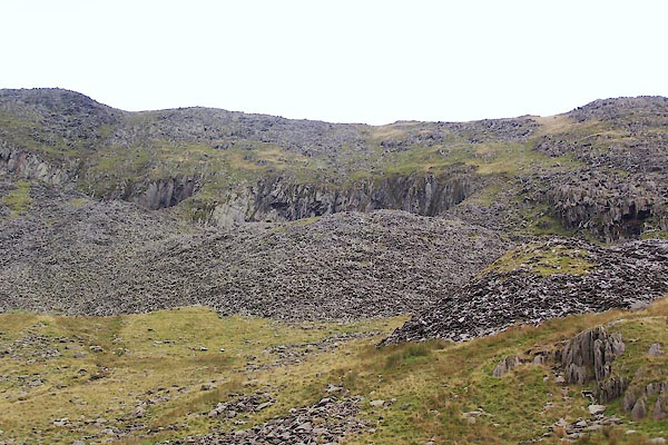 BTN35.jpg (taken 8.9.2010) |
||
|
|
||
| evidence:- | old map:- OS County Series (Lan 4) placename:- Cove Quarries |
|
| source data:- | Maps, County Series maps of Great Britain, scales 6 and 25
inches to 1 mile, published by the Ordnance Survey, Southampton,
Hampshire, from about 1863 to 1948. "Cove Quarries" |
|
|
|
||
| evidence:- | old map:- OS County Series (Lan 4) placename:- Low Quarry item:- slate |
|
| source data:- | Maps, County Series maps of Great Britain, scales 6 and 25
inches to 1 mile, published by the Ordnance Survey, Southampton,
Hampshire, from about 1863 to 1948. "Low Quarry (Slate)" |
|
|
|
||
| evidence:- | old map:- OS County Series (Lan 4) placename:- Middle Quarry item:- slate |
|
| source data:- | Maps, County Series maps of Great Britain, scales 6 and 25
inches to 1 mile, published by the Ordnance Survey, Southampton,
Hampshire, from about 1863 to 1948. "Middle Quarry (Slate)" |
|
|
|
||
| evidence:- | old map:- OS County Series (Lan 4) placename:- High Quarry item:- slate |
|
| source data:- | Maps, County Series maps of Great Britain, scales 6 and 25
inches to 1 mile, published by the Ordnance Survey, Southampton,
Hampshire, from about 1863 to 1948. "High Quarry (Slate)" on Old Man Breast |
|
|
|
||
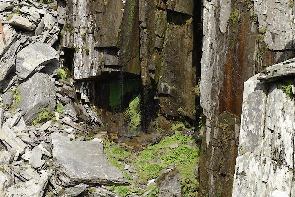
| MN photo:- |
Low Quarry, at SD27169717 etc. |
|
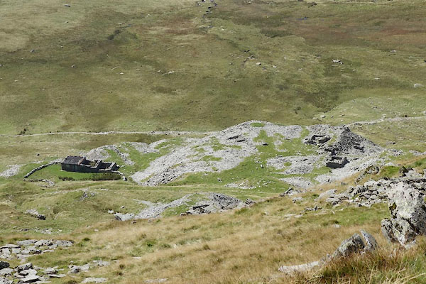 CBP13.jpg (taken 2.9.2014) 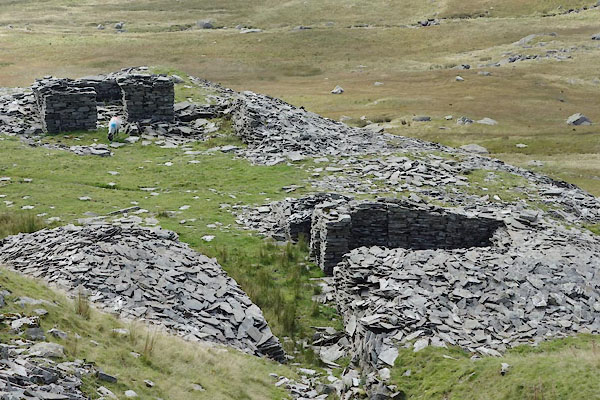 CBP14.jpg (taken 2.9.2014) 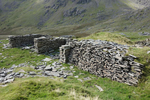 CBP15.jpg (taken 2.9.2014) 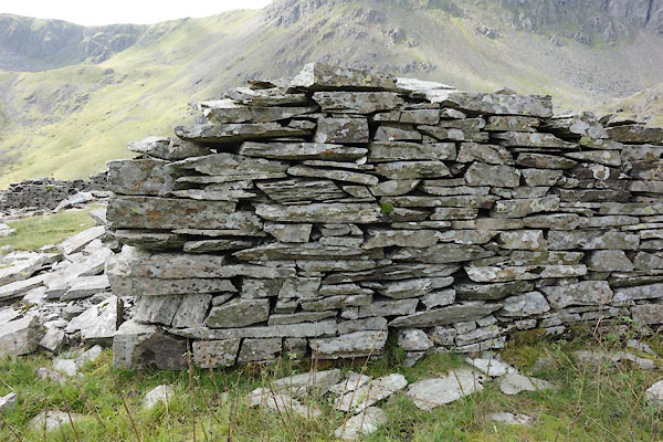 CBP16.jpg Stone wall, (taken 2.9.2014) 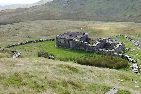 CBP17.jpg One building is now a climbing hut, (taken 2.9.2014) 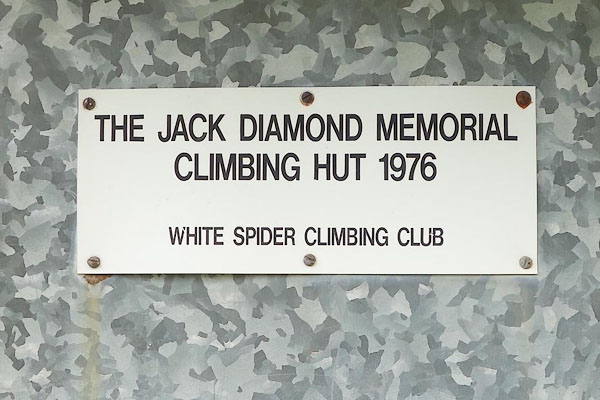 CBP18.jpg Sign:- "THE JACK DIAMOND MEMORIAL / CLIMBING HUT 1976 / WHITE SPIDER CLIMBING CLUB" (taken 2.9.2014) 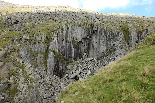 CBP19.jpg (taken 2.9.2014) 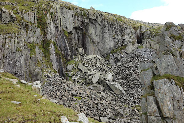 CBP20.jpg and notice a level. (taken 2.9.2014) |
||
|
|
||
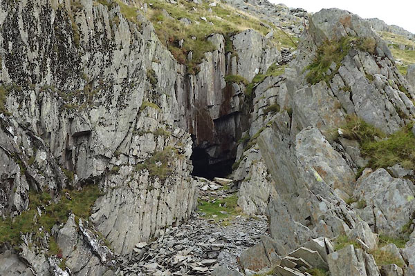
| MN photo:- |
Level in Low Quarry. |
|
 CBP21.jpg (taken 2.9.2014) 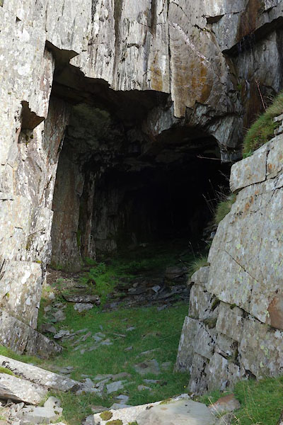 CBP22.jpg (taken 2.9.2014) 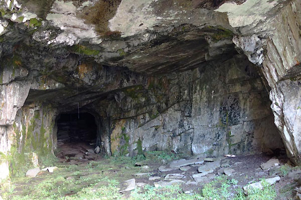 CBP23.jpg (taken 2.9.2014) |
||
|
|
||
| MN photo:- |
Level in Low Quarry. |
|
 CBP24.jpg (taken 2.9.2014) 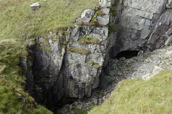 CBP25.jpg (taken 2.9.2014) |
||
|
|
||
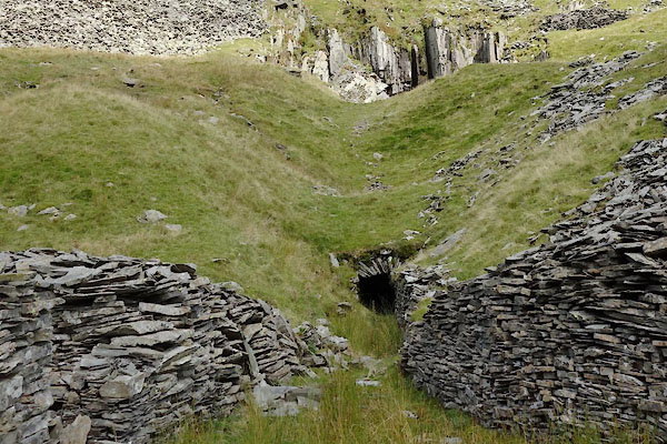
| MN photo:- |
Level in Low Quarry. |
|
 CBP26.jpg (taken 2.9.2014) 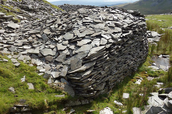 CBP27.jpg (taken 2.9.2014) 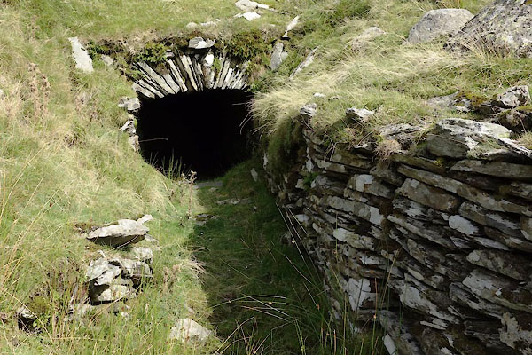 CBP28.jpg (taken 2.9.2014) 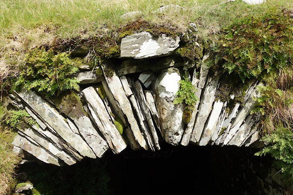 CBP29.jpg (taken 2.9.2014) 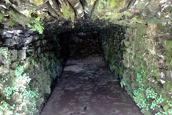 CBP30.jpg (taken 2.9.2014) |
||
|
|
||
| MN photo:- |
Level in Low Quarry. |
|
 CBP35.jpg (taken 2.9.2014) 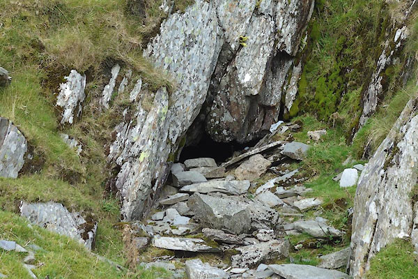 CBP36.jpg (taken 2.9.2014) 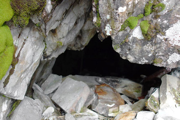 CBP37.jpg (taken 2.9.2014) |
||
|
|
||
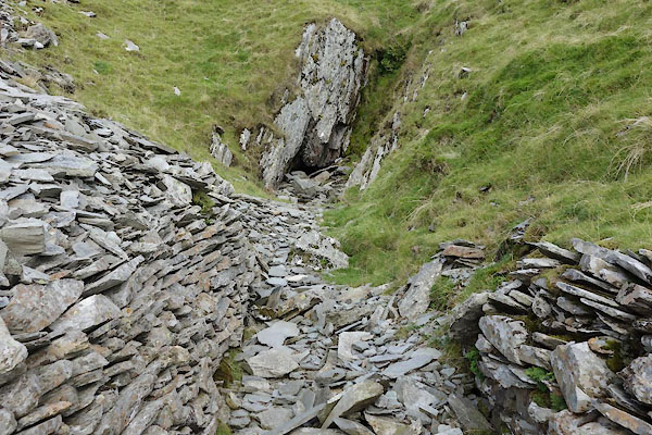
| MN photo:- |
Middle Quarry, SD27179736; and High Quarry, SD27139751. |
|
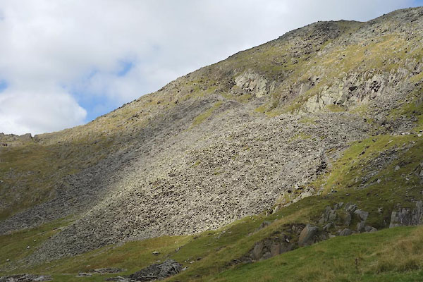 CBP31.jpg (taken 2.9.2014) 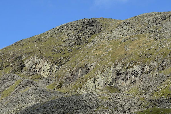 CBP32.jpg (taken 2.9.2014) |
||
|
|
||
| Glover, David: 2014: Quarries of Lakeland: Bookcase (Carlisle, Cumbria) |
||
|
|
||
 Lakes Guides menu.