 |
 |
   |
|
|
|
Glenridding |
| site name:- |
Glenridding Beck |
| civil parish:- |
Patterdale (formerly Westmorland) |
| county:- |
Cumbria |
| locality type:- |
valley |
| locality type:- |
locality |
| coordinates:- |
NY369172 (etc) |
| 1Km square:- |
NY3617 |
| 10Km square:- |
NY31 |
|
|
|
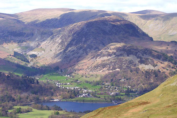
BNO85.jpg (taken 18.4.2007)
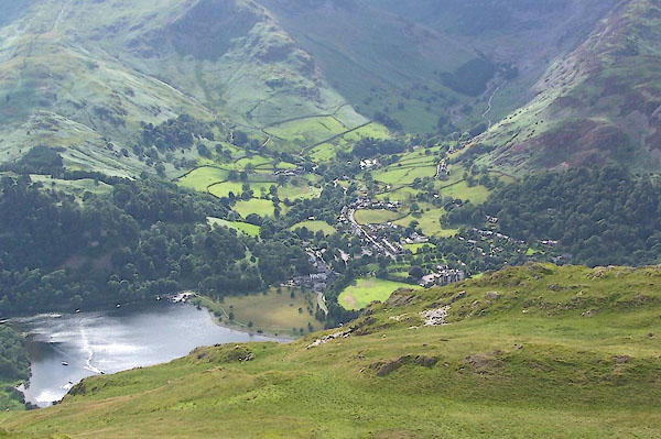
BRA09.jpg From Patterdale Common.
(taken 6.7.2009)
|
|
|
| evidence:- |
old map:- Jefferys 1770 (Wmd)
placename:- Glenridden
|
| source data:- |
Map, 4 sheets, The County of Westmoreland, scale 1 inch to 1
mile, surveyed 1768, and engraved and published by Thomas
Jefferys, London, 1770.
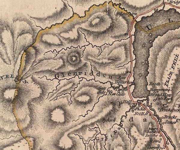
J5NY31NE.jpg
"Glenridden"
hill hachuring; valley
item:- National Library of Scotland : EME.s.47
Image © National Library of Scotland |
|
|
| evidence:- |
old map:- Cary 1789 (edn 1805)
placename:- Glenridden
|
| source data:- |
Map, uncoloured engraving, Westmoreland, scale about 2.5 miles
to 1 inch, by John Cary, London, 1789; edition 1805.
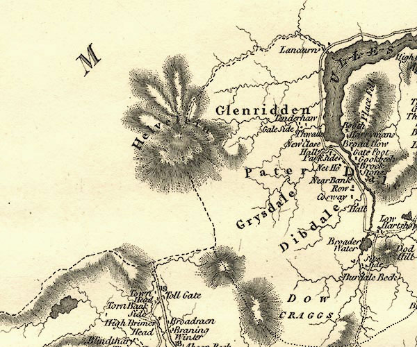
CY24NY31.jpg
"Glenridden"
area
item:- JandMN : 129
Image © see bottom of page
|
|
|
| evidence:- |
old text:- Wordsworth 1810
|
| source data:- |
Guide book, A Description of the Scenery of the Lakes, later A
Guide through the District of The Lakes, by William Wordsworth,
1810-35.
 goto source goto source
page xx "... at Glenridding Bridge, a fourth stream is crossed."
"The opening on the side of Ullswater Vale, down which this Stream flows, is adorned
with fertile fields, cottages, and natural groves, that agreeably unite with the transverse
views of the Lake; and the Stream, if followed up after the enclosures are left behind,
will lead along bold water-breaks and waterfalls to a silent Tarn in the recesses
of Helvellyn. ..."
|
|
|
| evidence:- |
old map:- Otley 1818
placename:- Glenridding
|
| source data:- |
Map, uncoloured engraving, The District of the Lakes,
Cumberland, Westmorland, and Lancashire, scale about 4 miles to
1 inch, by Jonathan Otley, 1818, engraved by J and G Menzies,
Edinburgh, Scotland, published by Jonathan Otley, Keswick,
Cumberland, et al, 1833.
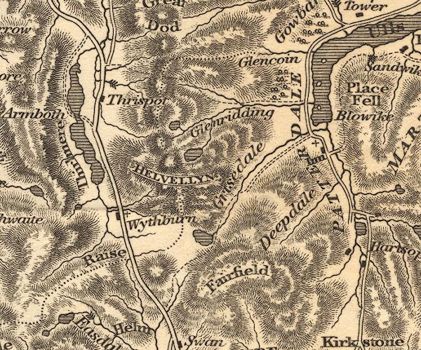
OT02NY31.jpg
item:- JandMN : 48.1
Image © see bottom of page
|
|
|
| evidence:- |
old map:- Ford 1839 map
placename:- Glenridding
|
| source data:- |
Map, uncoloured engraving, Map of the Lake District of
Cumberland, Westmoreland and Lancashire, scale about 3.5 miles
to 1 inch, published by Charles Thurnam, Carlisle, and by R
Groombridge, 5 Paternoster Row, London, 3rd edn 1843.
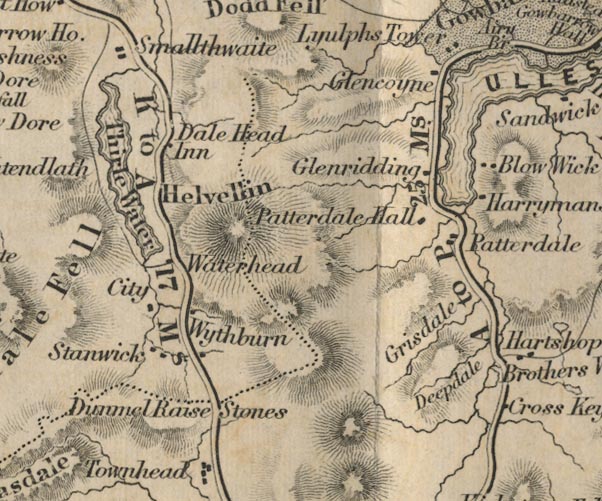
FD02NY31.jpg
"Glenridding"
item:- JandMN : 100.1
Image © see bottom of page
|
|
|
| evidence:- |
old map:- Garnett 1850s-60s H
placename:- Glenridding
|
| source data:- |
Map of the English Lakes, in Cumberland, Westmorland and
Lancashire, scale about 3.5 miles to 1 inch, published by John
Garnett, Windermere, Westmorland, 1850s-60s.
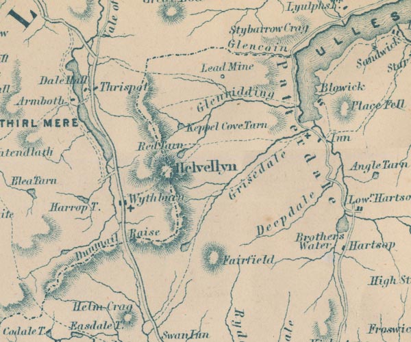
GAR2NY31.jpg
"Glenridding"
river valley
item:- JandMN : 82.1
Image © see bottom of page
|
|
|
| evidence:- |
old photograph:- Ullswater Steamers 1900s (edn 1903)
|
| source data:- |
Photograph, bw halftone, Glenridding Valley from Blowick, Patterdale, Westmorland,
published in a guide book by the Ullswater Steam Navigation Co, Penrith, Cumberland,
1903.
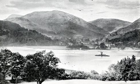 click to enlarge click to enlarge
UN125.jpg
printed, bottom "GLENRIDDING VALLEY FROM BLOWICK"
item:- JandMN : 1023.25
Image © see bottom of page
|
|
|
| evidence:- |
old photograph:- Photochrom 1930s
|
| source data:- |
Photograph, black and white halftone print, Ullswater from Place Fell, Patterdale,
Westmorland, published by Photochrom Co, Tunbridge Wells, Kent, 1930s?
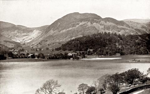 click to enlarge click to enlarge
PCH111.jpg
printed, "Ullswater from Place Fell. / ..."
item:- JandMN : 1015.11
Image © see bottom of page
|
|
|
| evidence:- |
outline view:- Black 1856 (23rd edn 1900)
placename:- Glenridding
|
| source data:- |
Print, lithograph, Outline Views, Ullswater - Mountains as seen a little on the Matterdale
Road near Lyulph's Tower on Ullswater, and Mountains as seen at the Slate Quarry at
Blowick on Ullswater, by J Flintoft, Keswick, Cumberland, engraved by R Mason, Edinburgh,
Lothian, about 1900.
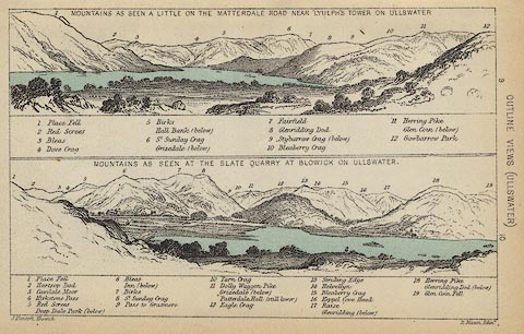 click to enlarge click to enlarge
BC08E2.jpg
"... Glenridding ..."
item:- JandMN : 37.8
Image © see bottom of page
|
|
|
| evidence:- |
outline view:- Black 1841 (3rd edn 1846)
placename:- Glenridding
|
| source data:- |
Print, engraving, outline view, Mountains as seen a little on the Matterdale Road
near Lyulph's Tower on Ulleswater, and Mountains as seen at the Slate Quarry at Blowick
on Ulleswater, by J Flintoft, Keswick, Cumberland, engraved by R Mason, Edinburgh,
Lothian, about 1846.
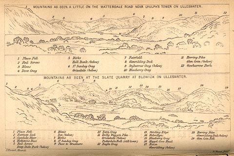 click to enlarge click to enlarge
BC02E9.jpg
"... Glenridding ..."
item:- JandMN : 32.15
Image © see bottom of page
|
|
|


 goto source


 click to enlarge
 click to enlarge
 click to enlarge
 click to enlarge