 Old Cumbria Gazetteer
 |
 |
|
| Kittygills, Lakes | ||
| gone? | ||
| Kittygills | ||
| civil parish:- | Lakes (formerly Westmorland) | |
| county:- | Cumbria | |
| locality type:- | buildings | |
| coordinates:- | NY386018 (estimate) | |
| 1Km square:- | NY3801 | |
| 10Km square:- | NY30 | |
| references:- | Jefferys 1770 |
|
|
|
||
| evidence:- | old map:- Jefferys 1770 (Wmd) placename:- Kitty Gills |
|
| source data:- | Map, 4 sheets, The County of Westmoreland, scale 1 inch to 1
mile, surveyed 1768, and engraved and published by Thomas
Jefferys, London, 1770.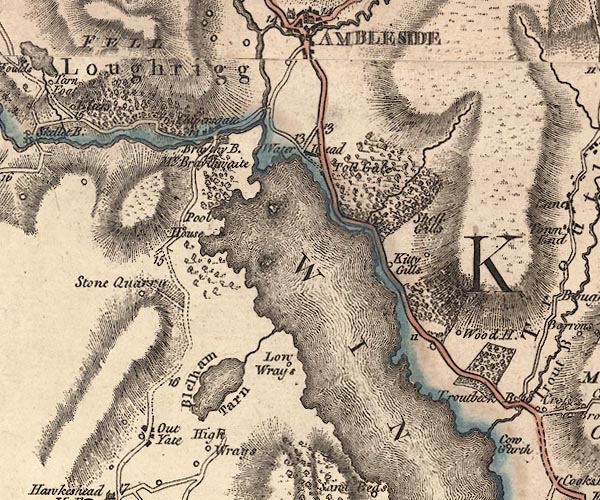 J5NY30SE.jpg "Kitty Gills" circle, labelled in italic lowercase text; settlement, farm, house, or hamlet? item:- National Library of Scotland : EME.s.47 Image © National Library of Scotland |
|
|
|
||
| evidence:- | old map:- Cary 1789 (edn 1805) placename:- Killy Gills |
|
| source data:- | Map, uncoloured engraving, Westmoreland, scale about 2.5 miles
to 1 inch, by John Cary, London, 1789; edition 1805.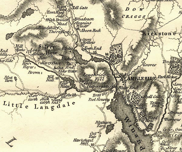 CY24NY30.jpg "Killy Gills" block/s, labelled in italic lowercase; house, or hamlet item:- JandMN : 129 Image © see bottom of page |
|
|
|
||
| evidence:- | old map:- Cooke 1802 placename:- Kitty Gills |
|
| source data:- | Map, Westmoreland ie Westmorland, scale about 12 miles to 1
inch, by George Cooke, 1802, published by Sherwood, Jones and
Co, Paternoster Road, London, 1824. click to enlarge click to enlargeGRA1Wd.jpg "Kitty Gills" blocks, italic lowercase text, village, hamlet, locality item:- Hampshire Museums : FA2000.62.4 Image © see bottom of page |
|
|
|
||
| evidence:- | old map:- Laurie and Whittle 1806 placename:- Kitty Gills |
|
| source data:- | Road map, Completion of the Roads to the Lakes, scale about 10
miles to 1 inch, by Nathaniel Coltman? 1806, published by Robert
H Laurie, 53 Fleet Street, London, 1834. click to enlarge click to enlargeLw18.jpg "Kitty Gills" village or other place item:- private collection : 18.18 Image © see bottom of page |
|
|
|
||
| evidence:- | old map:- Wallis 1810 (Wmd) placename:- Kitty Gills |
|
| source data:- | Road map, Westmoreland, scale about 19 miles to 1 inch, by James
Wallis, 77 Berwick Street, Soho, 1810, published by W Lewis,
Finch Lane, London, 1835? click to enlarge click to enlargeWAL5.jpg "Kitty Gills" village, hamlet, house, ... item:- JandMN : 63 Image © see bottom of page |
|
|
|
||
| evidence:- | old map:- Ford 1839 map placename:- Kittygills |
|
| source data:- | Map, uncoloured engraving, Map of the Lake District of
Cumberland, Westmoreland and Lancashire, scale about 3.5 miles
to 1 inch, published by Charles Thurnam, Carlisle, and by R
Groombridge, 5 Paternoster Row, London, 3rd edn 1843.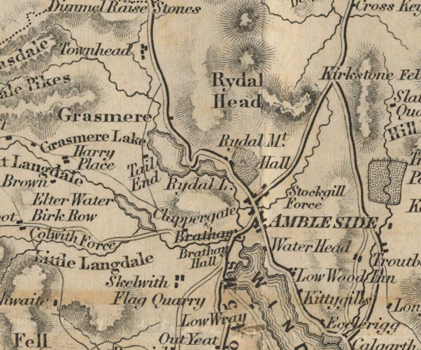 FD02NY30.jpg "Kittygills" item:- JandMN : 100.1 Image © see bottom of page |
|
|
|
||
 Lakes Guides menu.