 Old Cumbria Gazetteer
 |
 |
|
| Low Houses, Alston Moor | ||
| Low Houses | ||
| locality:- | Beldy | |
| locality:- | Garrigill | |
| civil parish:- | Alston Moor (formerly Cumberland) | |
| county:- | Cumbria | |
| locality type:- | buildings | |
| coordinates:- | NY74214204 | |
| 1Km square:- | NY7442 | |
| 10Km square:- | NY74 | |
|
|
||
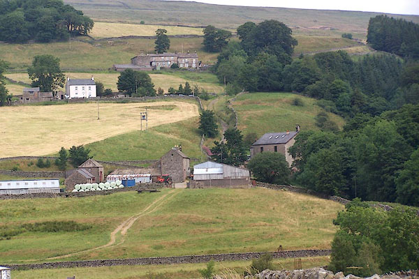 BML44.jpg (taken 29.7.2006) |
||
|
|
||
| evidence:- | old map:- OS County Series (Cmd 42 6) placename:- Low Houses placename:- Houses, Low |
|
| source data:- | Maps, County Series maps of Great Britain, scales 6 and 25
inches to 1 mile, published by the Ordnance Survey, Southampton,
Hampshire, from about 1863 to 1948. |
|
|
|
||
| evidence:- | possibly old map:- Saxton 1579 placename:- Howses, The |
|
| source data:- | Map, hand coloured engraving, Westmorlandiae et Cumberlandiae Comitatus ie Westmorland
and Cumberland, scale about 5 miles to 1 inch, by Christopher Saxton, London, engraved
by Augustinus Ryther, 1576, published 1579-1645.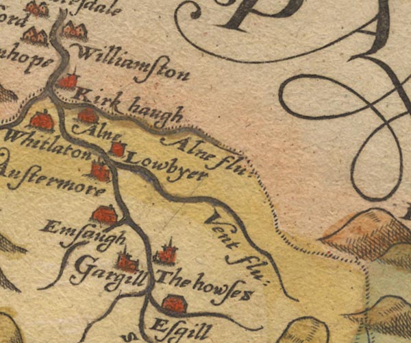 Sax9NY74.jpg Church, symbol for a parish or village, with a parish church. "The howses" item:- private collection : 2 Image © see bottom of page |
|
|
|
||
| evidence:- | possibly old map:- Keer 1605 placename:- Howses, The |
|
| source data:- | Map, hand coloured engraving, Westmorland and Cumberland, scale
about 16 miles to 1 inch, probably by Pieter van den Keere, or
Peter Keer, about 1605 edition perhaps 1676. click to enlarge click to enlargeKER8.jpg "The howses" dot, circle and tower; village item:- Dove Cottage : 2007.38.110 Image © see bottom of page |
|
|
|
||
| evidence:- | possibly old map:- Speed 1611 (Cmd) placename:- Houses, The |
|
| source data:- | Map, hand coloured engraving, Cumberland and the Ancient Citie
Carlile Described, scale about 4 miles to 1 inch, by John Speed,
1610, published by J Sudbury and George Humble, Popes Head
Alley, London, 1611-12.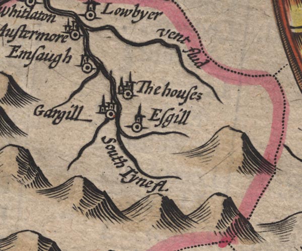 SP11NY74.jpg "The houses" circle, building, tower item:- private collection : 16 Image © see bottom of page |
|
|
|
||
| evidence:- | possibly old map:- Jenner 1643 placename:- Howses, The |
|
| source data:- | Tables of distances with a maps, Westmerland, scale about 16
miles to 1 inch, and Cumberland, scale about 21 miles to 1 inch,
published by Thomas Jenner, London, 1643; published 1643-80. JEN4Sq.jpg "The howses" circle |
|
|
|
||
| evidence:- | old map:- Jansson 1646 placename:- Houses, The |
|
| source data:- | Map, hand coloured engraving, Cumbria and Westmoria, ie
Cumberland and Westmorland, scale about 3.5 miles to 1 inch, by
John Jansson, Amsterdam, Netherlands, 1646.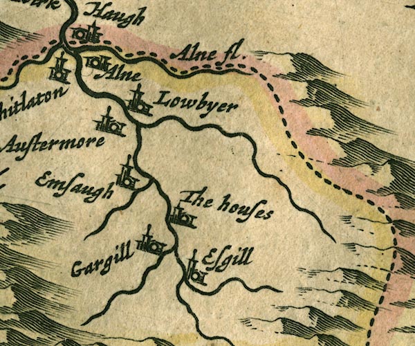 JAN3NY74.jpg "The houses" Buildings and tower. item:- JandMN : 88 Image © see bottom of page |
|
|
|
||
| evidence:- | possibly old map:- Morden 1695 (Cmd) placename:- Houses, The |
|
| source data:- | Map, uncoloured engraving, Cumberland, scale about 4 miles to 1
inch, by Robert Morden, 1695, published by Abel Swale, the
Unicorn, St Paul's Churchyard, Awnsham, and John Churchill, the
Black Swan, Paternoster Row, London, 1695-1715.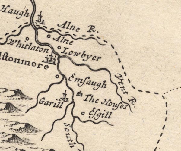 MD12NY74.jpg "The Houses" Drawing of a house. item:- JandMN : 90 Image © see bottom of page |
|
|
|
||
| evidence:- | possibly old map:- Bowen and Kitchin 1760 placename:- Houses, The |
|
| source data:- | Map, hand coloured engraving, A New Map of the Counties of
Cumberland and Westmoreland Divided into their Respective Wards,
scale about 4 miles to 1 inch, by Emanuel Bowen and Thomas
Kitchin et al, published by T Bowles, Robert Sayer, and John
Bowles, London, 1760.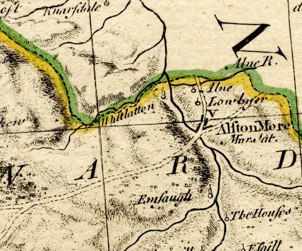 BO18NY74.jpg "The Houses" circle and line item:- Armitt Library : 2008.14.10 Image © see bottom of page |
|
|
|
||
 Lakes Guides menu.