 Old Cumbria Gazetteer
 |
 |
|
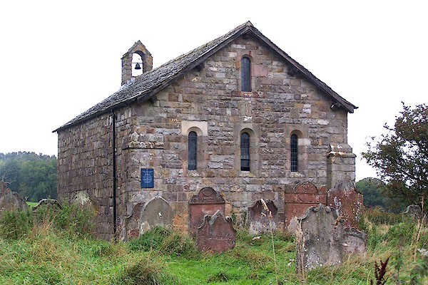
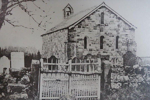
| Ireby Old Chancel, Ireby | ||
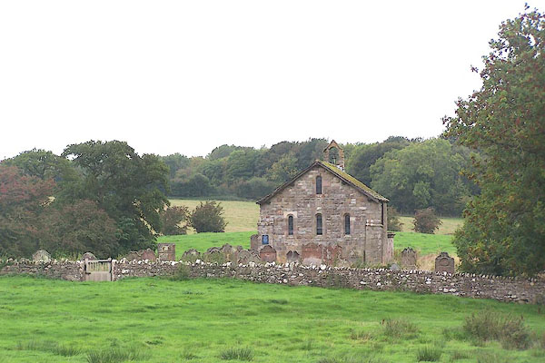
| Ireby Old Chancel | ||
| locality:- | Ireby | |
| civil parish:- | Ireby (formerly Cumberland) | |
| county:- | Cumbria | |
| locality type:- | church | |
| coordinates:- | NY22393930 | |
| 1Km square:- | NY2239 | |
| 10Km square:- | NY23 | |
|
|
||
 BMS22.jpg (taken 29.9.2006) 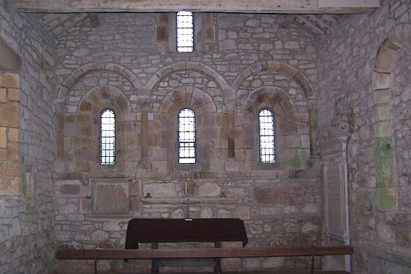 BMS23.jpg (taken 29.9.2006) |
||
|
|
||
| evidence:- | old map:- OS County Series (Cmd 36 16) |
|
| source data:- | Maps, County Series maps of Great Britain, scales 6 and 25
inches to 1 mile, published by the Ordnance Survey, Southampton,
Hampshire, from about 1863 to 1948. "Church (Remains of) / Grave Yard / Crosses (Pedestals of)" |
|
|
|
||
| evidence:- | old map:- Saxton 1579 |
|
| source data:- | Map, hand coloured engraving, Westmorlandiae et Cumberlandiae Comitatus ie Westmorland
and Cumberland, scale about 5 miles to 1 inch, by Christopher Saxton, London, engraved
by Augustinus Ryther, 1576, published 1579-1645.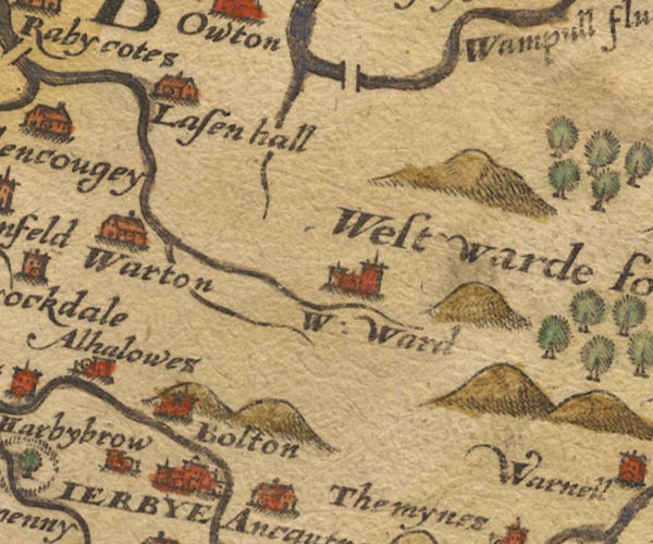 SAX9NY24.jpg unlabelled circle and tower, W of Ireby item:- private collection : 2 Image © see bottom of page |
|
|
|
||
| evidence:- | old map:- Speed 1611 (Cmd) |
|
| source data:- | Map, hand coloured engraving, Cumberland and the Ancient Citie
Carlile Described, scale about 4 miles to 1 inch, by John Speed,
1610, published by J Sudbury and George Humble, Popes Head
Alley, London, 1611-12.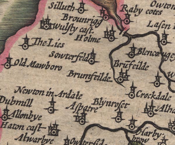 SP11NY14.jpg circle, tower; W of Ireby item:- private collection : 16 Image © see bottom of page |
|
|
|
||
| evidence:- | old map:- Jansson 1646 |
|
| source data:- | Map, hand coloured engraving, Cumbria and Westmoria, ie
Cumberland and Westmorland, scale about 3.5 miles to 1 inch, by
John Jansson, Amsterdam, Netherlands, 1646.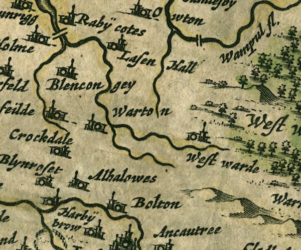 JAN3NY24.jpg Buildings and tower, W of Ireby. item:- JandMN : 88 Image © see bottom of page |
|
|
|
||
| evidence:- | old map:- Morden 1695 (Cmd) |
|
| source data:- | Map, uncoloured engraving, Cumberland, scale about 4 miles to 1
inch, by Robert Morden, 1695, published by Abel Swale, the
Unicorn, St Paul's Churchyard, Awnsham, and John Churchill, the
Black Swan, Paternoster Row, London, 1695-1715.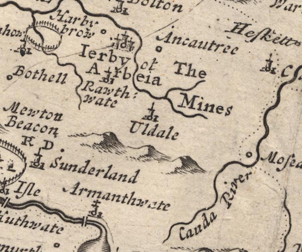 MD12NY23.jpg "Harby brow" Circle. item:- JandMN : 90 Image © see bottom of page |
|
|
|
||
| evidence:- | old map:- Donald 1774 (Cmd) placename:- Ireby Church |
|
| source data:- | Map, hand coloured engraving, 3x2 sheets, The County of Cumberland, scale about 1
inch to 1 mile, by Thomas Donald, engraved and published by Joseph Hodskinson, 29
Arundel Street, Strand, London, 1774.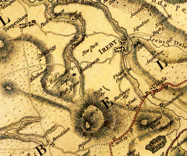 D4NY23NW.jpg "Ireby Church" church item:- Carlisle Library : Map 2 Image © Carlisle Library |
|
|
|
||
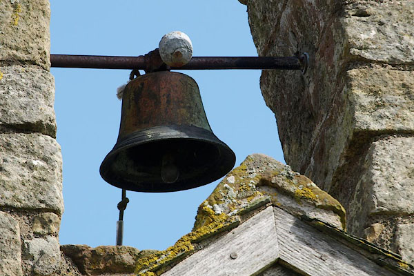 BSL32.jpg The bell. (taken 4.4.2010) |
||
|
|
||
| evidence:- | database:- Listed Buildings 2010 placename:- Ireby Old Church |
|
| source data:- | courtesy of English Heritage "IREBY OLD CHURCH / / / IREBY AND ULDALE / ALLERDALE / CUMBRIA / I / 72445 / NY2239139304" |
|
| source data:- | courtesy of English Heritage "Redundant parish church. C12 with 1845-6 alterations; restorations of 1880 by Ewan Christian and 1972 for the Redundant Churches Fund. Large blocks of squared mixed sandstone and limestone with eastern angle buttresses, partly on chamfered plinth. Graduated greenslate roof. 2-bay chancel only, with west open bellcote; (the nave, north aisle and porch were demolished 1845-6). West doorway in blocked chancel arch has C19 surround under reused C12 tympanum and built-in medieval grave slab. North blocked doorway and C18 square window partly in C16 chamfered surround. 3 narrow round-headed east windows and one above, all with heavy 1880 restoration, in rebuilt wall which has built into it 2 small medieval grave slabs and a larger slab in 3 separate pieces. Interior has 3-bay wall arcade in restored east wall. Open timber roof has C16 or C17 trusses. South wall has 2 blocked C13 windows, not visible from the outside because of C19 refacing. Wall plaque to George Crage of Prior Hall, 1626 and aedicule monument to Thomas Wilson 1769. Medieval piscina and 2 aumbries. Built into the east wall as part of C19 restoration is a stone altar shelf with incised medieval cross above and a grave slab inscribed in Lombardie capitals HIC JACET EVA FIL. Disused after new church was built in Ireby village and declared redundant in 1972. See Transactions Cumberland & Westmorland Antiquarian &Archaeological Society, new series, lxv, pp222-239." |
|
|
|
||
| evidence:- | database:- Listed Buildings 2010 |
|
| source data:- | courtesy of English Heritage "AISLE COLUMNS WEST OF IREBY OLD CHURCH / / / IREBY AND ULDALE / ALLERDALE / CUMBRIA / II[star] / 72446 / NY2237239311" |
|
| source data:- | courtesy of English Heritage "2 aisle columns. C13. Sandstone. Octagonal columns and capitals. When the church was partly demolished in 1845-6 these columns were used as gate posts for The Limes in Ireby village. Excavations in 1933-4 located the bases for these columns and after the restoration of the remaining chancel in 1972, the columns were returned to their original position. See Transactions Cumberland & Westmorland Antiquarian &Archaeological Society, new series, lxv, pp222-239." |
|
|
|
||
 cross slab gravestones cross slab gravestones |
||
|
|
||
 BMS21.jpg (taken 29.9.2006) 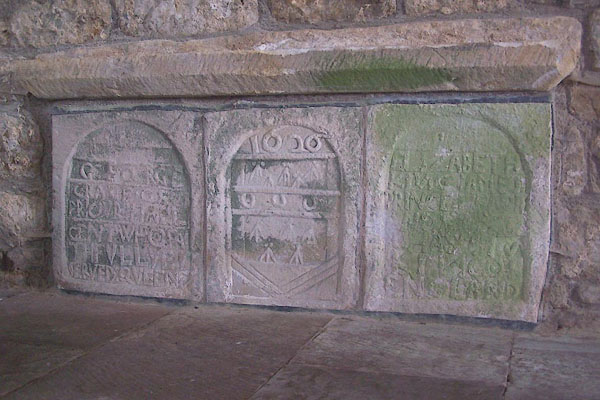 BMS24.jpg Memorial to:- "GEORGE CRAGE OF PRIOR HALL GENT WHO FAITHFULLYE SERVED QUEEN ELIZABETH KING JAMES PRINCE HENRY AND KING CHARLES KING OF ENGLAND" (taken 29.9.2006) 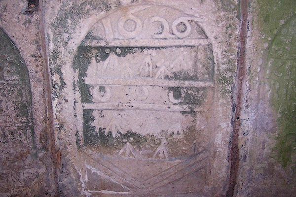 BMS25.jpg Coat of arms of George Crage, 1626. (taken 29.9.2006) 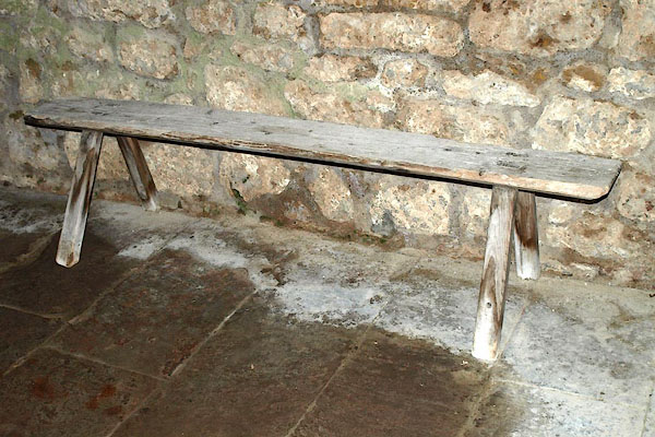 BQI12.jpg A simple bench. (taken 27.3.2009) 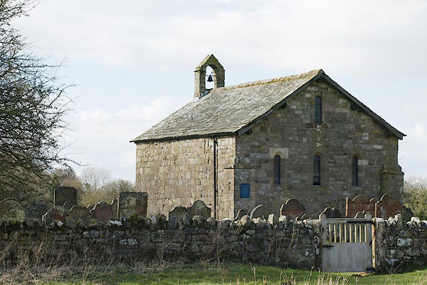 BSL31.jpg (taken 4.4.2010) |
||
|
|
||
 CBJ90.jpg (taken 15.8.2014) |
||
|
|
||
| notes:- |
The chancel is the only part remaining from the old parish church. It was built in
the mid 12th century; enlarged about 1170; a north aisle added to the nave in the
13th century; much was demolished in 1845-46 when the new parish church was built;
the chancel was restored to good order in 1880. |
|
| : : church leaflet |
||
|
|
||
 Lakes Guides menu.