 Old Cumbria Gazetteer
 |
 |
|
| Wrynose Fell, Lakes | ||
| Wrynose Fell | ||
| civil parish:- | Lakes (formerly Westmorland) | |
| county:- | Cumbria | |
| locality type:- | hill | |
| locality type:- | fell | |
| coordinates:- | NY27940413 (etc) | |
| 1Km square:- | NY2704 | |
| 10Km square:- | NY20 | |
|
|
||
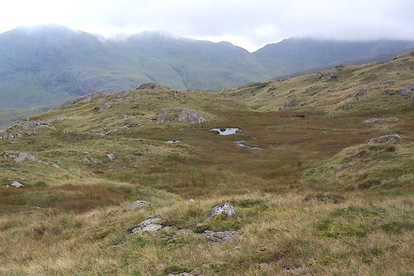 BXG81.jpg (taken 3.9.2012) 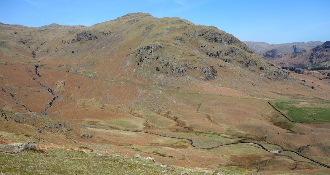 Click to enlarge CCX77.jpg Blakerigg etc. (taken 22.4.2015) |
||
|
|
||
| evidence:- | old map:- Mercator 1595 (edn?) placename:- Wrenose hill |
|
| source data:- | Map, hand coloured engraving, Northumbria, Cumberlandia, et
Dunelmensis Episcopatus, ie Northumberland, Cumberland and
Durham etc, scale about 6.5 miles to 1 inch, by Gerard Mercator,
Duisberg, Germany, about 1595.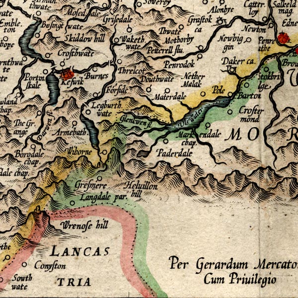 MER8CumF.jpg "Wrenose hill" hillock, shaded on east; hill or mountain, on county boundary item:- JandMN : 169 Image © see bottom of page |
|
|
|
||
| evidence:- | probably old map:- Drayton 1612/1622 placename:- Wenrose Hill |
|
| source data:- | Map, hand coloured engraving, Cumberlande and Westmorlande, by
Michael Drayton, probably engraved by William Hole, scale about
4 or 5 miles to 1 inch, published by John Mariott, John
Grismand, and Thomas Dewe, London, 1622.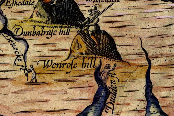 DRY522.jpg "Wenrose hill" Hillock, gentleman sitting on top, with a staff. item:- JandMN : 168 Image © see bottom of page |
|
|
|
||
| evidence:- | old map:- Jefferys 1770 (Wmd) placename:- Wrynose Knab |
|
| source data:- | Map, 4 sheets, The County of Westmoreland, scale 1 inch to 1
mile, surveyed 1768, and engraved and published by Thomas
Jefferys, London, 1770.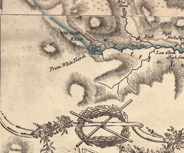 J5NY20SE.jpg "WRYNOSE KNAB" hill hachuring; hill or mountain, across county boundary item:- National Library of Scotland : EME.s.47 Image © National Library of Scotland |
|
|
|
||
| evidence:- | old map:- Donald 1774 (Cmd) placename:- Wrey Nose |
|
| source data:- | Map, hand coloured engraving, 3x2 sheets, The County of Cumberland, scale about 1
inch to 1 mile, by Thomas Donald, engraved and published by Joseph Hodskinson, 29
Arundel Street, Strand, London, 1774.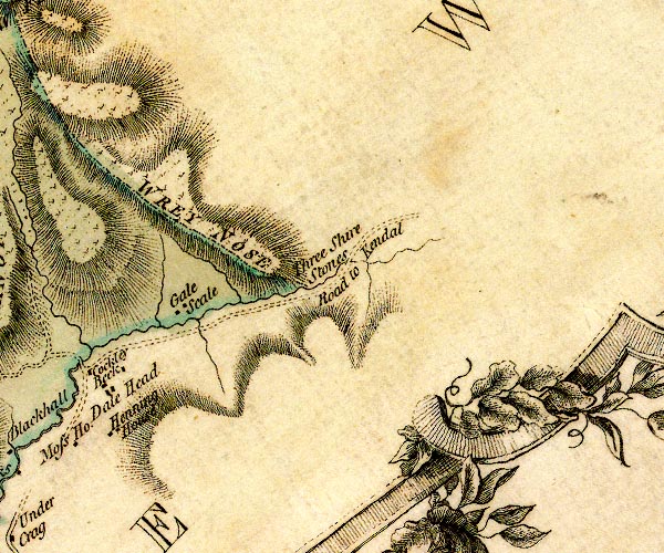 D4NY20SE.jpg "WREY NOSE" hill hachuring; hill or mountain, on county boundary item:- Carlisle Library : Map 2 Image © Carlisle Library |
|
|
|
||
| evidence:- | old map:- Cooke 1802 placename:- Wrynose |
|
| source data:- | Map, The Lakes, Westmorland and Cumberland, scale about 8.5
miles to 1 inch, engravedby Neele and Son, published by
Sherwood, Jones and Co, Paternoster Road, London, 1824. click to enlarge click to enlargeGRA1Lk.jpg "Wrynose" hillock; mountain item:- Hampshire Museums : FA2000.62.5 Image © see bottom of page |
|
|
|
||
| evidence:- | old text:- Gents Mag placename:- Wryknot placename:- Hardnose item:- placename, Wrynose; placename, Hardknott |
|
| source data:- | Magazine, The Gentleman's Magazine or Monthly Intelligencer or
Historical Chronicle, published by Edward Cave under the
pseudonym Sylvanus Urban, and by other publishers, London,
monthly from 1731 to 1922. goto source goto sourceGentleman's Magazine 1805 p.919 "... Before us rose, in a magnificent cluster, the rocks of Hardnose, Wryknot, ..." |
|
|
|
||
| evidence:- | old text:- Gents Mag 1805 item:- placename, Wrynose |
|
| source data:- | goto source Gentleman's Magazine 1805 p.1012 "..." "Erratum.- In the last paper, for Wryknot, read Wrynose; for Hardnose, read Hardknot." "The origin of these outlandish terms has been in some few instances successfully traced from the Greek, from the connexion existing between that language and the antient Celtic. The Author submits to the decision of his readers a conjecture with which he has been favoured on the derivation of the name Wrynose, viz. the Greek |
|
|
|
||
| evidence:- | old map:- Cooper 1808 placename:- Wry Nose |
|
| source data:- | Map, uncoloured engraving, Cumberland, scale about 10.5 miles to
1 inch, drawn and engraved by Cooper, published by R Phillips,
Bridge Street, Blackfriars, London, 1808. click to enlarge click to enlargeCOP3.jpg "Wry Nose" hill hachuring; mountain or hill, on county boundary item:- JandMN : 86 Image © see bottom of page |
|
|
|
||
| evidence:- | old map:- Garnett 1850s-60s H placename:- Wrynose |
|
| source data:- | Map of the English Lakes, in Cumberland, Westmorland and
Lancashire, scale about 3.5 miles to 1 inch, published by John
Garnett, Windermere, Westmorland, 1850s-60s.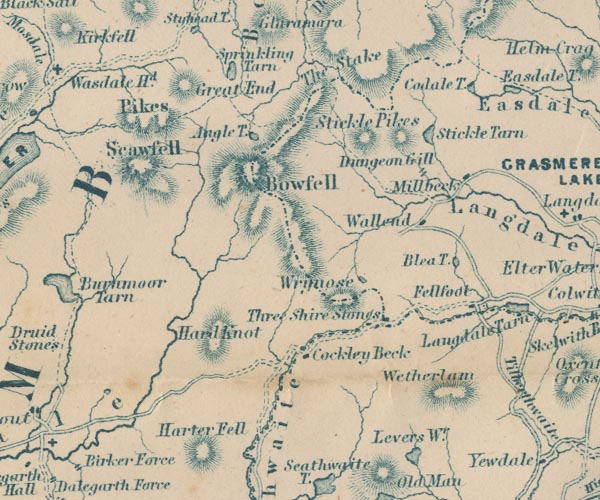 GAR2NY20.jpg "Wrynose" hill hachuring item:- JandMN : 82.1 Image © see bottom of page |
|
|
|
||
| evidence:- | outline view:- Linton 1852 placename:- Wrynose |
|
| source data:- | Print, engraving, outline views, Mountains as Seen from the Esk Viaduct, the Eskmeals
Viaduct, and Mountains as Seen from the Viaduct near Drigg, the Irt Viaduct, Whitehaven
and Furness Junction Railway, Cumberland, engraved by W H Lizars, Edinburgh, published
by Whittaker and Co, London, and by R Gibson and Son and by Callander and Dixon, Whitehaven,
Cumberland, 1852.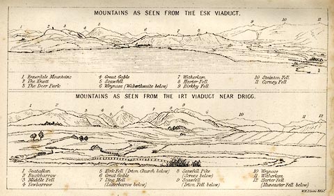 click to enlarge click to enlargeLN1E13.jpg Tipped in opposite p.86 of A Handbook of the Whitehaven and Furness Railway, by John Linton. item:- Armitt Library : A1158.11 Image © see bottom of page |
|
|
|
||
Lakes Guides menu.