 Old Cumbria Gazetteer
 |
 |
|
| Whitewater Dash, Bassenthwaite | ||
| Whitewater Dash | ||
| site name:- | Dash Beck | |
| civil parish:- | Bassenthwaite (formerly Cumberland) | |
| civil parish:- | Ireby (formerly Cumberland) | |
| county:- | Cumbria | |
| locality type:- | waterfall | |
| coordinates:- | NY27213134 (etc) | |
| 1Km square:- | NY2731 | |
| 10Km square:- | NY23 | |
|
|
||
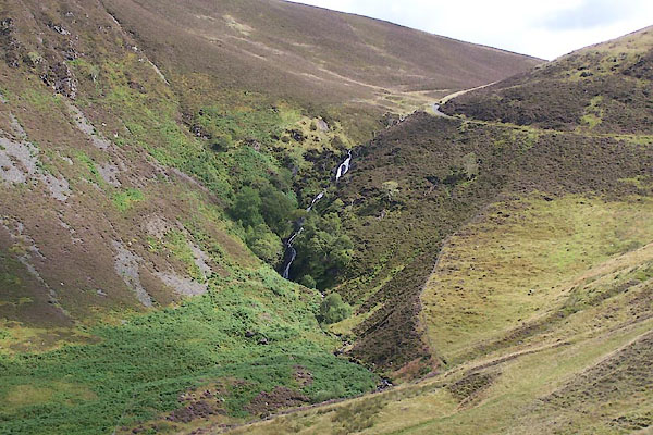 BVE81.jpg (taken 8.8.2011) 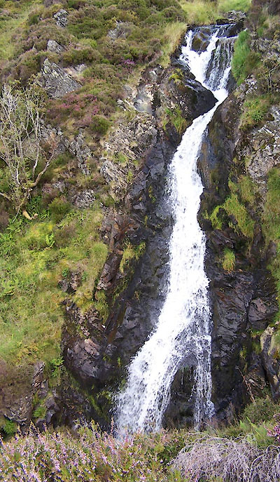 BVE82.jpg (taken 8.8.2011) |
||
|
|
||
| evidence:- | old map:- OS County Series (Cmd 56 2) placename:- Whitewater Dash |
|
| source data:- | Maps, County Series maps of Great Britain, scales 6 and 25
inches to 1 mile, published by the Ordnance Survey, Southampton,
Hampshire, from about 1863 to 1948. |
|
|
|
||
| evidence:- | old map:- Donald 1774 (Cmd) placename:- White Water Dash |
|
| source data:- | Map, hand coloured engraving, 3x2 sheets, The County of Cumberland, scale about 1
inch to 1 mile, by Thomas Donald, engraved and published by Joseph Hodskinson, 29
Arundel Street, Strand, London, 1774.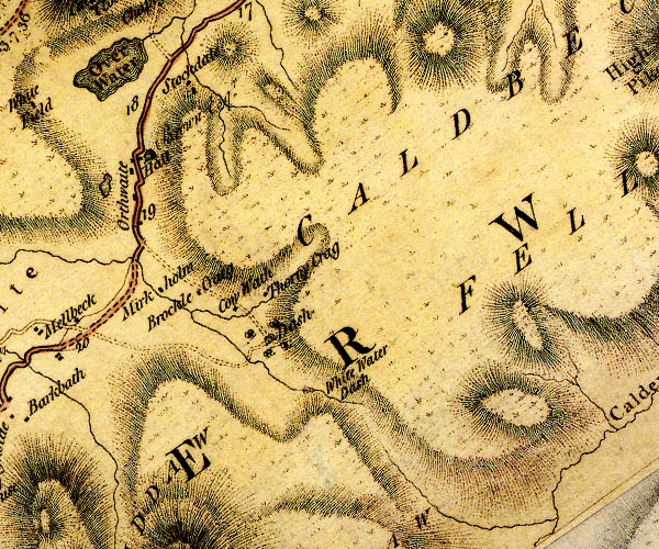 D4NY23SE.jpg "White Water Dash" with a ravine below item:- Carlisle Library : Map 2 Image © Carlisle Library |
|
|
|
||
| evidence:- | descriptive text:- Otley 1823 (5th edn 1834) placename:- White Water Dash |
|
| source data:- | Guide book, A Concise Description of the English Lakes, the
mountains in their vicinity, and the roads by which they may be
visited, with remarks on the mineralogy and geology of the
district, by Jonathan Otley, published by the author, Keswick,
Cumberland now Cumbria, by J Richardson, London, and by Arthur
Foster, Kirkby Lonsdale, Cumbria, 1823; published 1823-49,
latterly as the Descriptive Guide to the English Lakes. goto source goto sourcePage 43:- "WHITE WATER DASH, on the north of Skiddaw, is conspicuous from the road between Ireby and Bassenthwaite; and viewed from its foot, with the lofty Dead Crag on the right, is a good picture." |
|
|
|
||
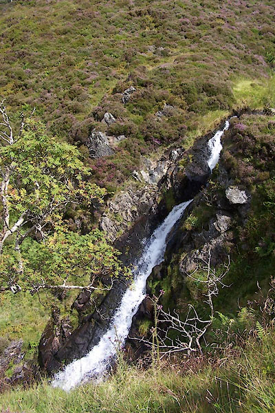 BVE83.jpg (taken 8.8.2011) 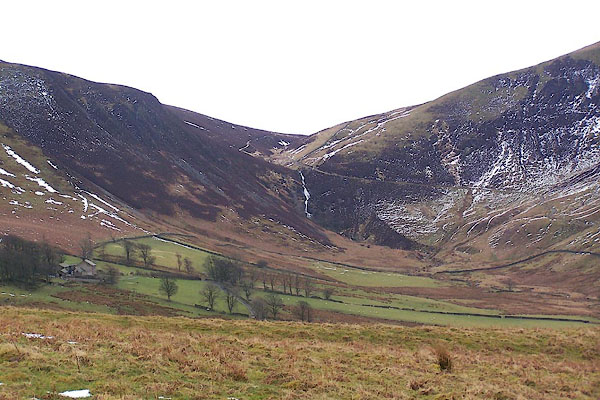 BSL59.jpg (taken 4.4.2010) |
||
|
|
||
Lakes Guides menu.