 Old Cumbria Gazetteer
 |
 |
|
| Ullock Pike, Bassenthwaite | ||
| Ullock Pike | ||
| site name:- | Skiddaw | |
| civil parish:- | Bassenthwaite (formerly Cumberland) | |
| civil parish:- | Underskiddaw (formerly Cumberland) | |
| county:- | Cumbria | |
| locality type:- | hill | |
| locality type:- | boundary feature | |
| locality type:- | parish boundary feature | |
| coordinates:- | NY24392884 | |
| 1Km square:- | NY2428 | |
| 10Km square:- | NY22 | |
|
|
||
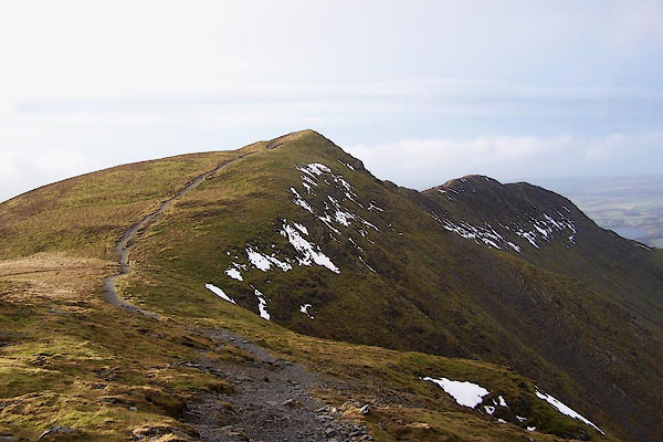 BPW06.jpg (taken 17.12.2008) 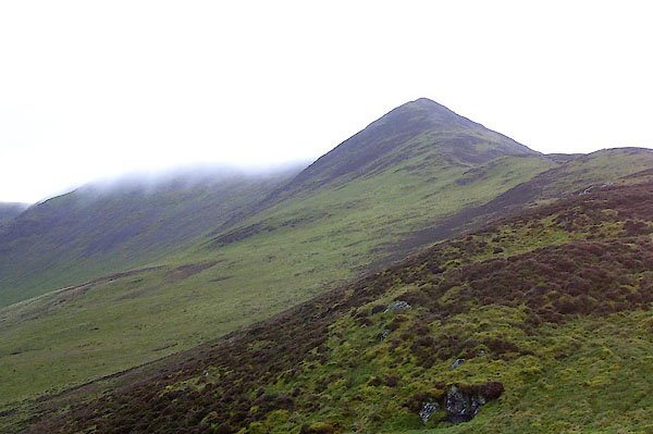 BOJ57.jpg (taken 29.11.2007) |
||
|
|
||
| evidence:- | old map:- OS County Series (Cmd 56 5) placename:- Ullock Pike |
|
| source data:- | Maps, County Series maps of Great Britain, scales 6 and 25
inches to 1 mile, published by the Ordnance Survey, Southampton,
Hampshire, from about 1863 to 1948. |
|
|
|
||
| evidence:- | outline view:- Otley 1823 (4th edn 1830) placename:- Ullock |
|
| source data:- | Print, engraving, Outline View of Skiddaw, and Saddleback, as seen on approaching
Keswick from the South, published by Jonathan Otley, Keswick, Cumberland et al, 1830.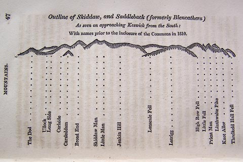 click to enlarge click to enlargeO75E01.jpg p.47 in A Concise Description of the English Lakes, by Jonathan Otley, 4th edition, 1830. "Outline View of Skiddaw, and Saddleback (formerly Blencathera) As seen on approaching Keswick from the South: With names prior to the inclosure of the Commons in 1810." "The Dod / Ullock / Long Side / Carleside / Carsleddam / Broad End / Skiddaw Man / Little Man / Jenkin Hill / Lonscale Fell / Latrigg / High Row Fell / Little Fell / Priest Man / Linthwaite Pike / Knot Aller / Threlkeld Hall Fell" item:- Armitt Library : A1175.2 Image © see bottom of page |
|
|
|
||
| evidence:- | outline view:- Otley 1823 (8th edn 1849) placename:- Hullock |
|
| source data:- | Engraving, outline view of mountains, Skiddaw, and Saddleback ... as seen on entering
Keswick from the South, drawn by T Binns, engraved by O Jewitt, opposite p.46 of A
Descriptive Guide of the English Lakes, by Jonathan Otley, 8th edition, 1849.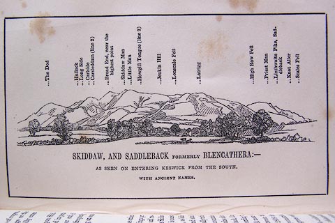 click to enlarge click to enlargeO80E16.jpg item:- Armitt Library : A1180.17 Image © see bottom of page |
|
|
|
||
| evidence:- | outline view:- Otley 1823 (5th edn 1834) placename:- Hullock |
|
| source data:- | Print, woodcut outline view, Skiddaw and Saddleback, by Jonathan Otley, Keswick, Cumberland,
1830.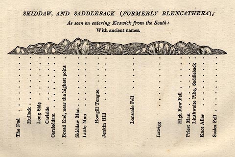 click to enlarge click to enlargeOT2E08.jpg Printed on p.49 of A Concise Description of the English Lakes, by Jonathan Otley, 5th edition, 1834. "SKIDDAW, AND SADDLEBACK (FORMERLY BLENCATHRA): As seen entering Keswick from the South: With ancient names." "The Dod / Hullock / Long Side / Carlside / Carsleddam / Broad End, near the highest point / Skiddaw Man / Little Man / Howgill Tongue / Jenkin Hill / Lonscale Fell / Latrigg / High Row Fell / Priest Man / Linthwaite Pike, Saddleback / Knot Aller / Scales Fell" item:- JandMN : 48.9 Image © see bottom of page |
|
|
|
||
| evidence:- | outline view:- Black 1856 (23rd edn 1900) placename:- Point of Ullock |
|
| source data:- | Print, lithograph, Outline Views, Skiddaw and Derwent Water - Mountains as seen at
Lodore Hotel, and Mountains as seen at the Third Gate on Ascending Latrigg on the
Way to Skiddaw, by J Flintoft, Keswick, Cumberland, engraved by R Mason, Edinburgh,
Lothian, about 1900.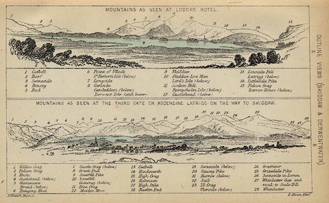 click to enlarge click to enlargeBC08E4.jpg "... 6 Point of Ullock ..." item:- JandMN : 37.14 Image © see bottom of page |
|
|
|
||
| evidence:- | outline view:- Black 1841 (3rd edn 1846) placename:- Point of Ullock |
|
| source data:- | Print, engraving, outline view, Mountains as seen at Lowdore Inn, and Mountains as
seen at the Third Gate on Ascending Latrigg on the Way to Skiddaw, by J Flintoft,
Keswick, Cumberland, engraved by R Mason, Edinburgh, Lothian, about 1846.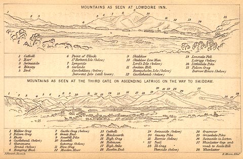 click to enlarge click to enlargeBC02E4.jpg "... 6 Point of Ullock ..." item:- JandMN : 32.7 Image © see bottom of page |
|
|
|
||
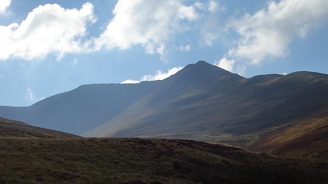 Click to enlarge CEB81.jpg From Southerndale. (taken 13.10.2015) 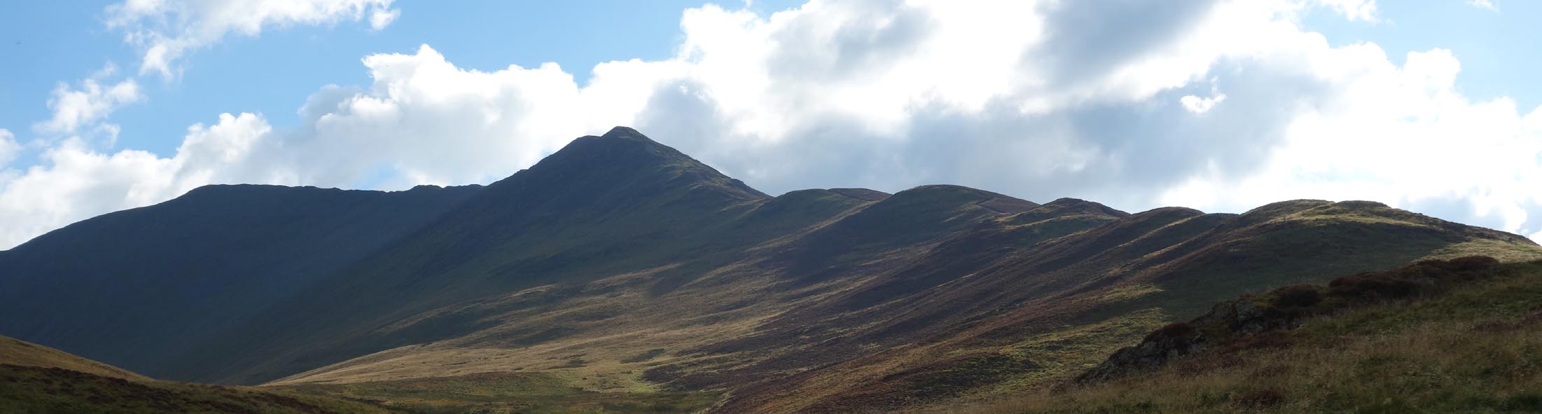 Click to enlarge CEB82.jpg From Southerndale. (taken 13.10.2015) |
||
|
|
||
 Lakes Guides menu.